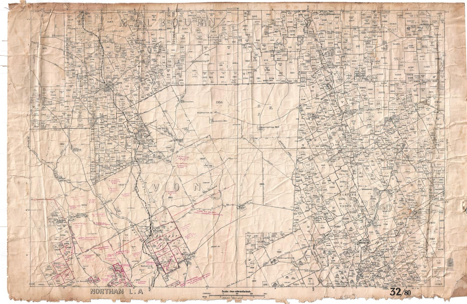
CADASTRAL MAP BOLGART, CALINGIRI AND TOODYAY
1938 - 1959Cadastral Map showing Bolgart, Calingiri, part of Goomalling and North Toodyay.
Map created by West Australian Survey Department.
Drawn in black ink, with areas of north Toodyay and Bolgart outlined in red pencil with further red ink notations of lot ownership by family name.
Produced on cloth paper backed by a rough cotton fabric.
The edges are frayed, especially along the bottom margin, where there is a great deal of flaking.
Captioned Northam L.A. (Land Agency)
The map is also distorted as it has been previously stored in a rolled state. Overall however the map is in a good to moderate condition.
The map is undated but the insignia of the then Surveyor General, W. V. Fyfe, provides a date of either 1938-1945 or 1948-1959.
It is unknown how this map came to be located in the Museum Workshop however it is assumed it was once used by the Shire’s Planning Department and then donated.
Details
Details
Captioned Northam L.A. (Land Agency)
Map number 32/80 26.7.30
Marked with official stamp of Walace Vernon Fyfe as Surveyor General of Western Australia. Fyfe served in this role 1938-1945 and 1948-1959
The Surveyor General of Western Australia is the person nominally responsible for government surveying in Western Australia.
In the early history of Western Australia, the office of surveyor general was one of the most important public offices. In modern times, the position of surveyor general has diminished in importance. It remains a statutory office, and is housed within the current agency named Landgate. https://en.wikipedia.org/wiki/Surveyor_General_of_Western_Australia
The value of this map lies in its research value as a dated map of property and other boundaries for areas of the Avon region.
While only of local significance, however it could be considered particularly valuable in its ability to demonstrate the development of the Toodyay landscape.
More items like this
Other items from Shire of Toodyay
-
DEVELOPMENT PLAN CONNOR'S MILL
-
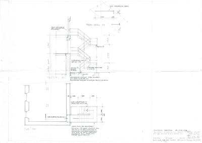
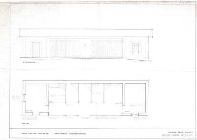
PROPOSED RESTORATION PLAN FOR NEWCASTLE POLICE STABLES, TOODYAY
-
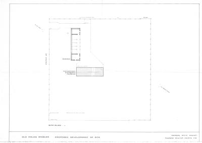
DEVELOPMENT PLAN, POLICE STABLES
-
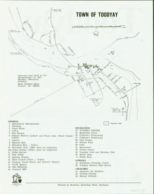
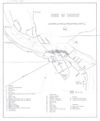
TOODYAY TOWN MAP 1989
-
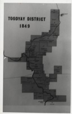
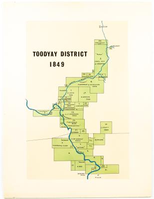
MAP TOODYAY DISTRICT 1849
-
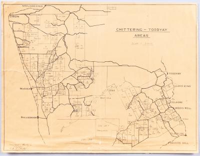
AVON SETTLEMENT MAP
-
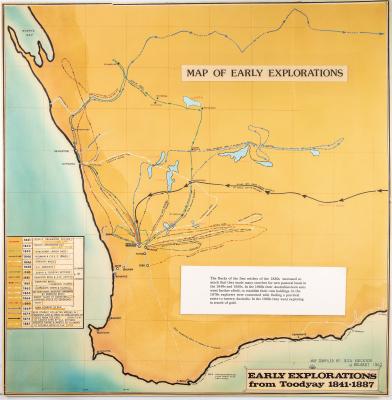
WESTERN AUSTRALIA EXPLORATION MAP
-
NEGATIVES, HISTORIC BUILDINGS
-
ALBUM; WEST TOODYAY BRIDGE OPENING CEREMONY

-
LEAP ALBUM, 1993

-
NEGATIVE IMAGES X 11, TOODYAY PUBLICITY

-
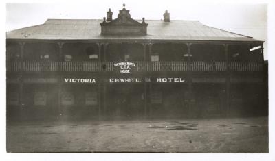
VICTORIA HOTEL, TOODYAY 1920/30
Scan this QR code to open this page on your phone ->