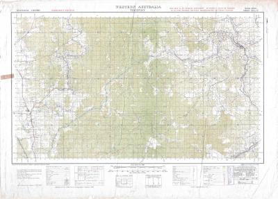
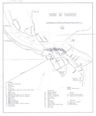
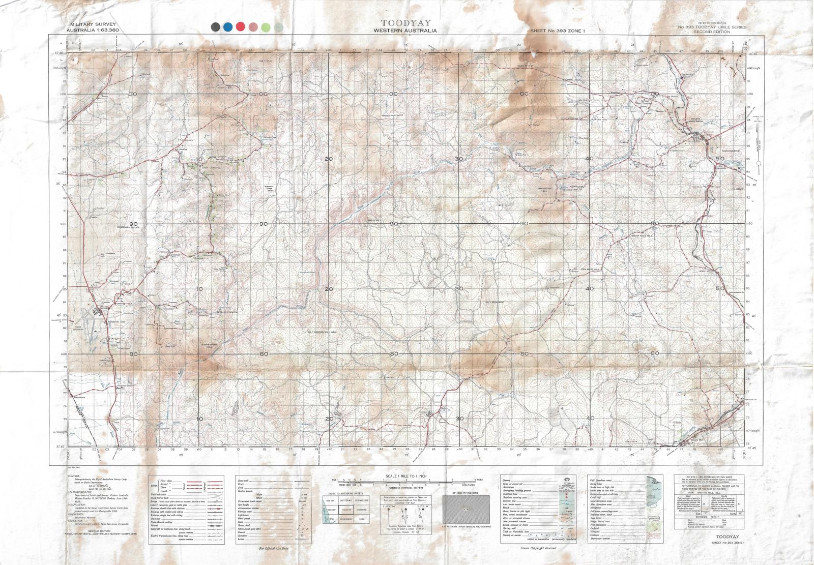
TOPOGRAPHICAL MAP, TOODYAY TO PEARCE AIR BASE
1958Topographic map of the Toodyay valley between the Toodyay town site and Pearce Air base.
The map is a reproduction created by the Royal Australian Survey Corps, a surveying and in addition to topography, vegetation and waterways, the map shows roads, railway lines, tracks, farm buildings and historic ruins.
Printed on paper with coloured inks and shows extensive light staining from water damage.
The map is also slightly creased as it has been previously folded. However despite this damage the map is in a good to moderate condition and is still legible.
This is one of a collection of cadastral five maps of the Avon region accessioned into the museum collection in 2012 (under accession numbers 2012.42 - 2012.46 inclusive). It is unknown how these five maps came to be located in the Museum Workshops however it is assumed they were once used by the Shire’s Planning Department and then donated.
Map produced by Royal Australian Survey Corps
Details
Details
Map produced by Royal Australian Survey corps
The Australian Survey Corps was formed in 1 July 1915, the title "Royal" was added 1948 and it was disbanded on 1 July 1996.
The Royal Australian Survey Corps was a surveying and map-making section of the Australian military that was formed in 1915 under the supervision of the British army. This corps supported the Australian military in World War I, World War II, Vietnam and was eventually disbanded in 1996. The map is dated to 1958, and was part of the ongoing efforts by the Corps to map Australia in its entirety.
The value of the items considered for accession lies in their research value as dated maps of land boundaries, farm buildings, tracks and rail lines for areas of the Avon region from 1942-1958. While these items are only of local significance, they are considered especially valuable in providing information for historical researchers in surrounding areas as well as Toodyay.
The Newcastle Gaol Museum currently has a number of 20th Century maps in the accessioned collection, including a small number of cadastral maps
Copyright and Reference
Copyright and Reference
Other items from Shire of Toodyay
-
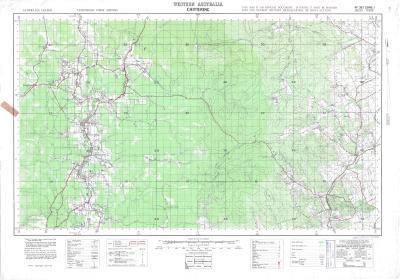
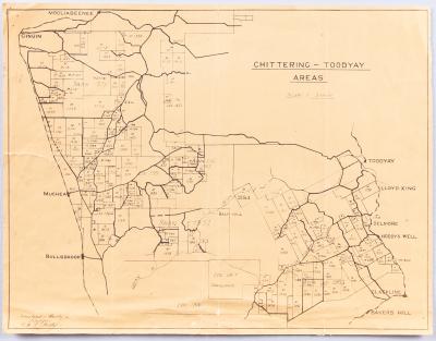
CADASTRAL / TOPOGRAPHIC MAP OF TOODYAY & BULLSBROOK
-
CADASTRAL / TOPOGRAPHIC MAP OF CULHAM TO SOUTH BINDOON
-
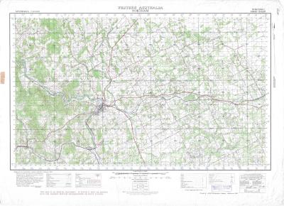
CASTRAL / TOPOGRAPHIC MAP: NORTHAM TO SOUTH TOODYAY
-
CADASTRAL MAP BOLGART, CALINGIRI AND TOODYAY
-
DEVELOPMENT PLAN CONNOR'S MILL
-
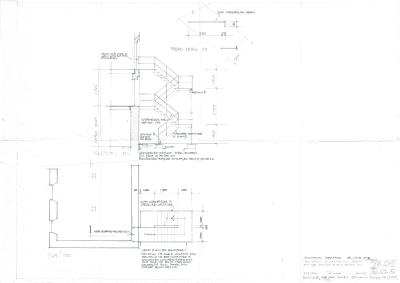
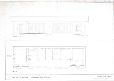
PROPOSED RESTORATION PLAN FOR NEWCASTLE POLICE STABLES, TOODYAY
-
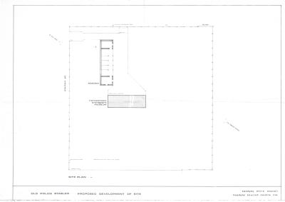
DEVELOPMENT PLAN, POLICE STABLES
-
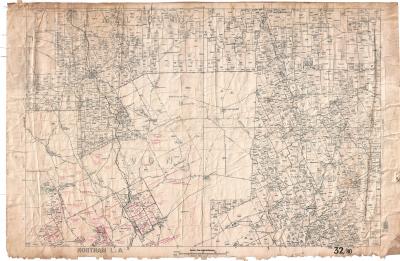
TOODYAY TOWN MAP 1989
-
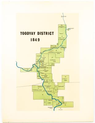
MAP TOODYAY DISTRICT 1849
-
AVON SETTLEMENT MAP
-
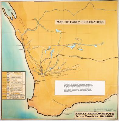
WESTERN AUSTRALIA EXPLORATION MAP
-
NEGATIVES, HISTORIC BUILDINGS
Scan this QR code to open this page on your phone ->