Shire of Toodyay > Records
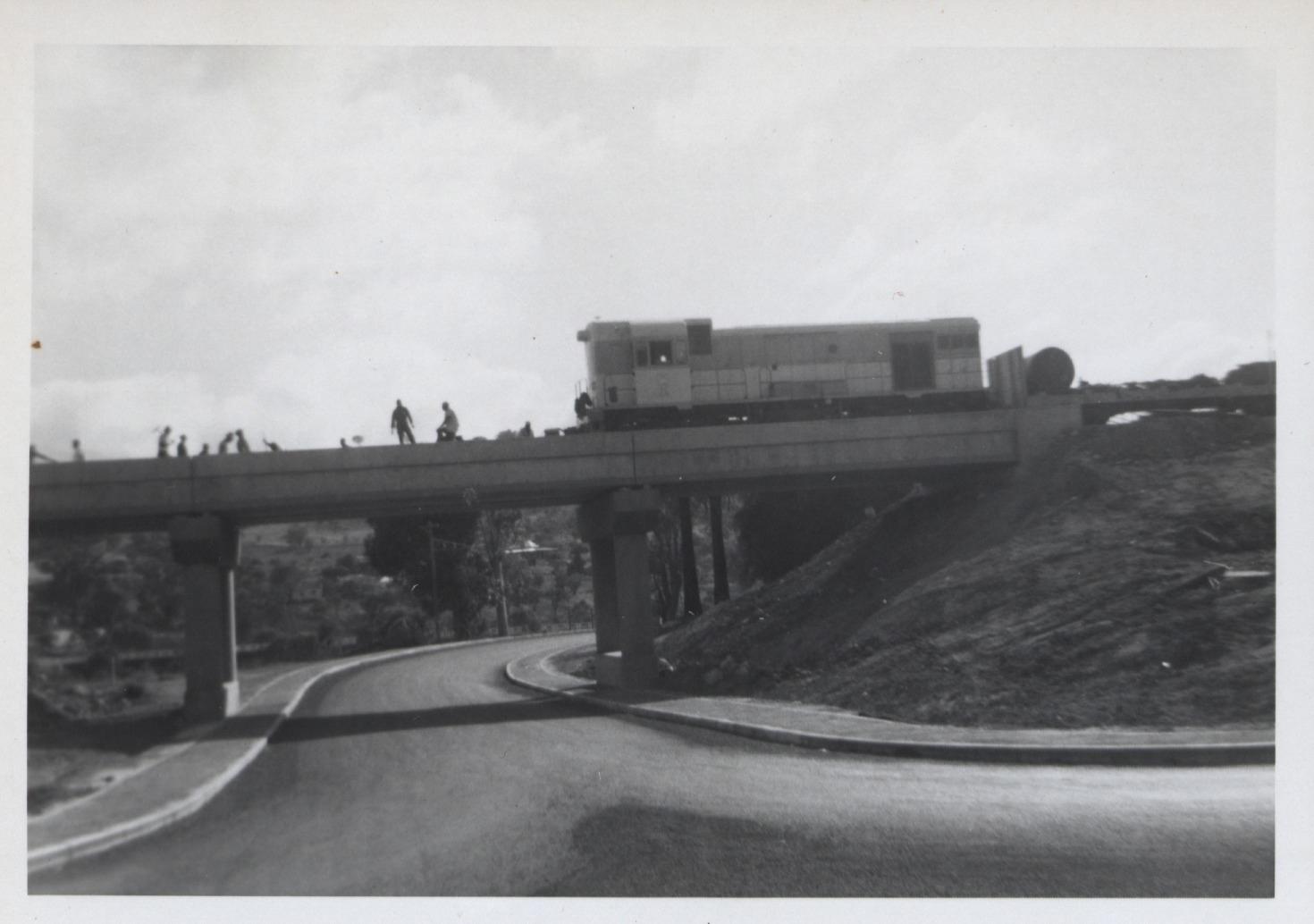
RAILWAY BRIDGE & NEW UNDERPASS AT TOODYAY
1964Subcollections
Overview
Black & white photo of locomotive crossing rail bridge at west end of Toodyay townsite taken from intersection of Anzac Tce to right - Harper Street to left.
Several men (workers) can be seen on bridge.
Footpath on both sides of road.
Details
Details
Registration number
cwa-org-37-2001-1744
Item type
Photographs
Themes
Material
Photographic Paper
Width
125 mm
Height or length
90 mm
Inscriptions and markings
Writing on the reverse of the photo states: "First train 1964"
Year
Primary significance criteria
Historic significance
Google Maps search term / URL
https://www.google.com/maps/embed?pb=!4v1647526674812!6m8!1m7!1sb13sYbgRB0GPLnTQg2fEgw!2m2!1d-31.55135078758431!2d116.4622632341636!3f31.783171090692356!4f0.8319528507988565!5f1.0847043037701627
Geotag
-31.551321363489, 116.46229796359
Open in Google Maps
Nearest geotagged records:
Nearby places: View all geotagged records »
Open in Google Maps
Nearest geotagged records:
- BUILDING STANDARD GAUGE RAILWAY LINE, TOODYAY 1964 (0.02km away)
- LOCOMOTIVE CROSSING HARPER ROAD RAILWAY BRIDGE (0.03km away)
- HARPERS COTTAGE (0.11km away)
- TOODYAY HOMES FOR THE AGED (BUTTERLY COTTAGES) (0.14km away)
- JULIA HARPER'S COTTAGE, TOODYAY (0.14km away)
- AVON RIVER FLOOD AT TOODYAY 1920S (0.17km away)
- BOARDING HOUSE DURING FLOODS OF 1955 (0.19km away)
- TOODYAY BOARDING HOUSE; FLOODED 1955 (0.2km away)
- OFFICIAL OPENING OF AVON RIVER BRIDGE, TOODYAY (0.21km away)
- VIEW OF FLOOD ON STIRLING TERRACE TOODYAY FROM CONNOR'S MILL (0.23km away)
Nearby places: View all geotagged records »
Last modified
Friday, 18 March, 2022
Completeness