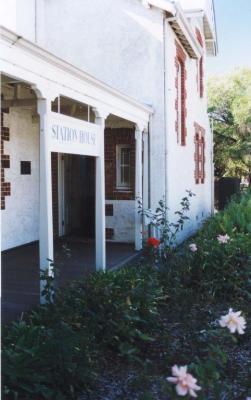
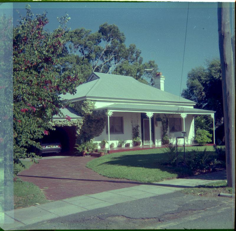
LANGSFORD ST, 1
Colour prints. (a) Brick house with iron roof, rendered front elevation painted white. Red cement floored verandah supported by metal posts with iron lace brackets. Central door flanked by a window on each side. Grass shaded by overhanging tree. (b) House from left showing double chimney with chimney pots, bitumen crossover, public footpath, brick drive, carport and surrounding trees.
Built in 1916 as presbytery for nearby Catholic Church in Reserve Street, No 1 was a brick house with iron roof and bullnosed front verandah, giving no outward sign of its use. There were timber arches between the turned verandah posts and on either side of the central door, full-length sash windows opening onto the verandah. The 2 front rooms were studies - one for parish priest, one for visiting clergy; then came the priest's bedroom and across the central passage the sitting and dining room. The passage opened into a vestibule with kitchen and a small room for the housekeeper on one side and bathroom and laundry on the other. Young curates who assisted the priest slept on the front verandah protected only by canvas blinds. A toilet was eventually installed on the back verandah to replace one abutting the back lane. In 1953 the priest moved to a presbytery closer to the new church in Melville Street. An English family, the Hannans, then purchased the property and during their 2 years there planted an oak which prospered on the northern boundary. The house was purchased at auction in 1955 for 3,900 pounds by John Rowe (Senator Tangney was a serious bidder). Rowe made considerable alterations - demolished free standing garage and removed central path, replacing them with carport and drive. Verandah floor and posts were replaced with concrete and iron to deter white ants.
Details
Details
Open in Google Maps
Nearest geotagged records:
- LANGSFORD STREET, 15 (0.11km away)
- World War 1, Australia, Western Australia, DIXON, 10 Light Horse (0.16km away)
- CLAREMONT HOTEL (0.25km away)
- CONGREGATIONAL CHURCH FOUNDATION STONE (0.26km away)
- CLAREMONT RAIILWAY STATION AND ENVIRONS (0.26km away)
- RESERVE STREET, 10 (0.27km away)
- AWAS on Rottnest - W45312 WILLIAMS D (0.27km away)
- 14 RESERVE ST (0.28km away)
- CLAREMONT RAILWAY STATION MASTER'S HOUSE (0.28km away)
- CLAREMONT STATION HOUSE (0.28km away)
View all geotagged records...
Other items from Claremont Museum
-
ARMY N.C.O. SCHOOL CLAREMONT DRILL HALL
-
UNITED BUS, SINGLE DECKER
-
UNITED BUS DRIVER & CONDUCTRESS
-
PRINTS X 4 - GRAYLANDS PRIMARY SCHOOL STUDENTS
-
SQUARE MAN ON BICYCLE FRAME
-
ELECTION CAMPAIGN - D TANGNEY
-
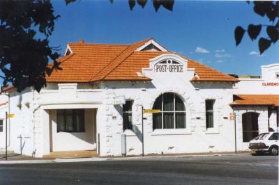
CLAREMONT POST OFFICE
-
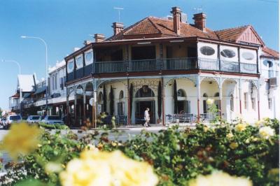
CLAREMONT HOTEL
-
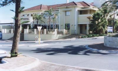
SWANBOURNE HOTEL
-
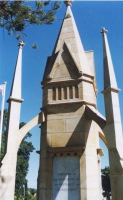
CLAREMONT WAR MEMORIAL
-
AERIAL VIEW OF CLAREMONT/NEDLANDS 1929
-
CLAREMONT STATION HOUSE