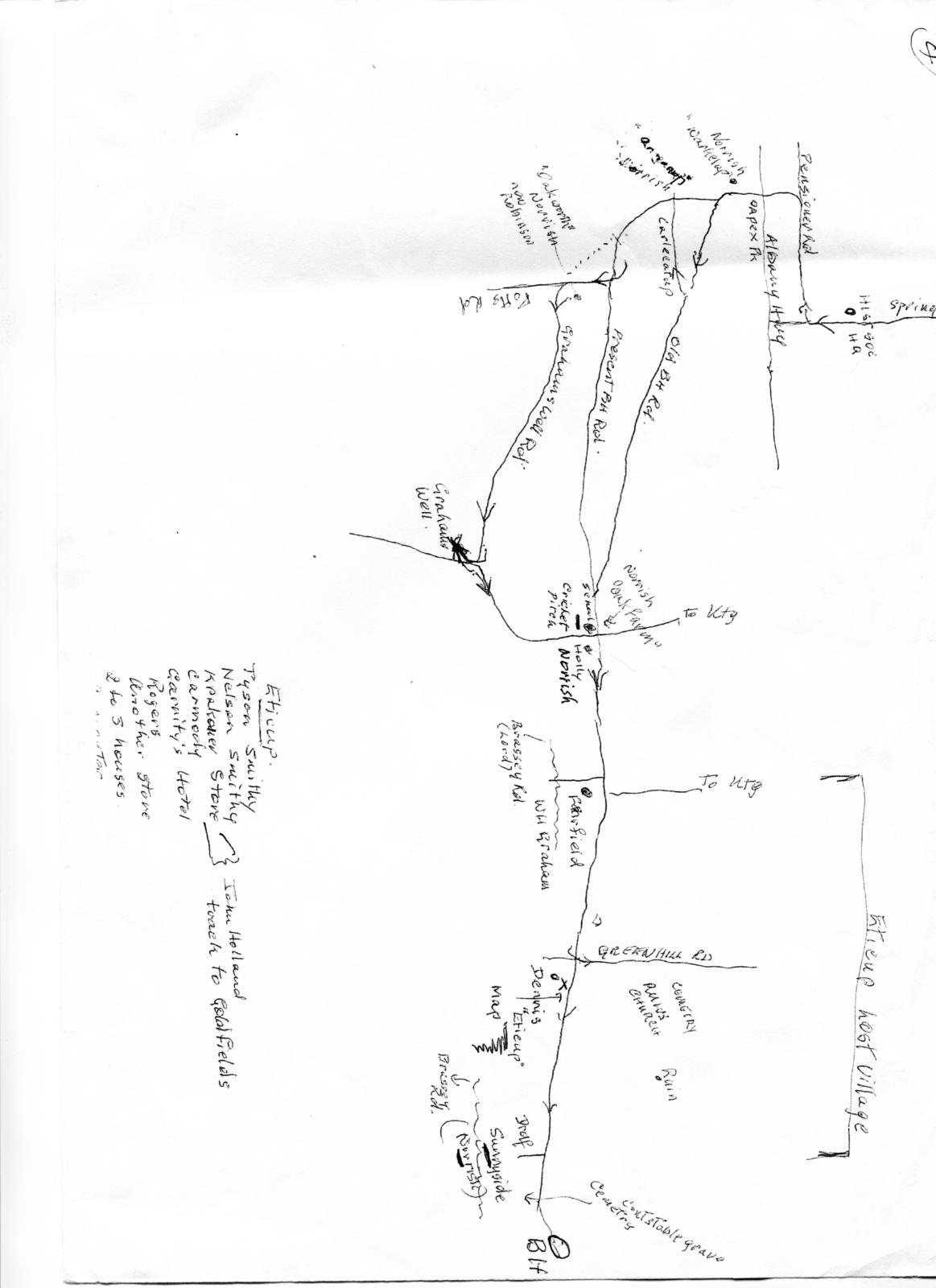
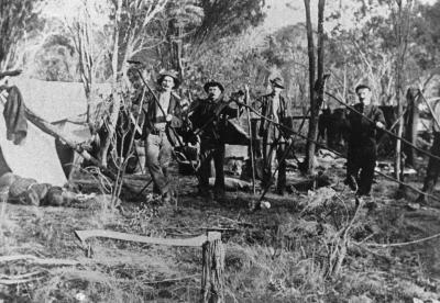
MUD MAP OF ETICUP
1860 - 1880Overview
This hand drawn map of the Eticup townsite is entitled Eticup - Lost Village. It shows the roads and some of the sites within the town as well as a list of businesses that were there. Eticup was between Kojonup and Broomehill and was supposed to be on the route of the Railway line but the line was re-routed and went through Broomhill- making that the bigger town. Krakouer Store was there and the John Holland track to the Goldfields was associated with this store. There is a cemetery and remnance of the town, which is in the Broomehill Shire.
Details
Details
Registration number
cwa-org-118-KPCW2026.23
Item type
Documents
Keywords
Year
Primary significance criteria
Historic significance
Social or spiritual significance
Last modified
Saturday, 21 February, 2026
Completeness
The Kodja Place Cultural Centre - Kojonup
The Kodja Place Cultural Centre - Kojonup
Other items from The Kodja Place Cultural Centre - Kojonup
-
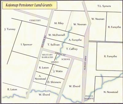
ENROLLED PENSIONER GUARD - EARLY P LOT LOCATIONS
-
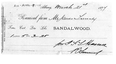
(Copy) THREE DOCUMENTS RELATED TO SANDALWOOD HARVESTING 1877-1888
-
(COPY) AUSTRALIAN NAT CHAMPONSHIPS WARWICK NSW
-
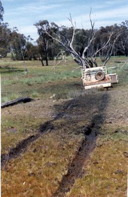
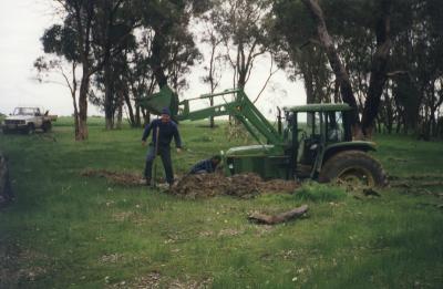
BOGGED!
-
BOGGED TRACTOR
-
ABORIGINAL CARTING CONTRACTORS ON FARM IN KULIKUP 1950'S
-
KOJONUP FIRE STATION DENNIS FIRE TRUCK

-
MARGARET AND JOHN BENN WITH PROTEAS

-
HARVESTING MALLET BARK
-
TREE ON BURNED FIRETRUCK IN AFTERMATH OF CYCLONE ALBY
-
FIRE FIGHTING AT JINGALUP, DECEMBER 1999.

-
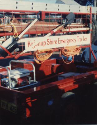
(Copy) KOJONUP SHIRE EMERGENCY TRAILER