AVONDALE BUILDINGS
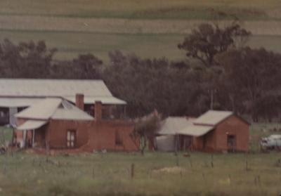
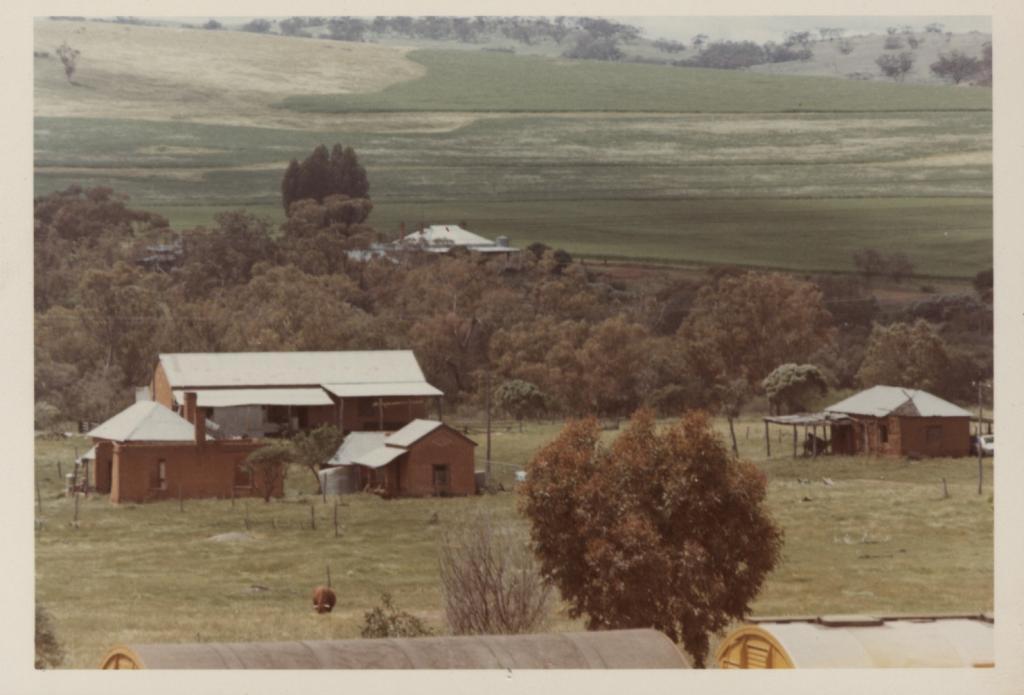
Colour print of Avondale buildings.
2 smaller buildings, one on left has 2 chimneys possibly a dwelling, smaller building outhouse or single accommodation, larger building in rear was winery, building on far right has lean-to verandah, white car under verandah. All buildings have iron roofs.
Belt of trees behind building.
House in background is not known if associated with Avondale.
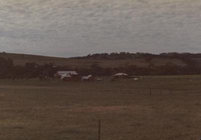
Open paddocks in background. In foreground is freight train which indicates photo was taken from West Toodyay marshalling yard.
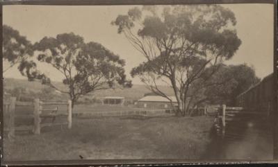
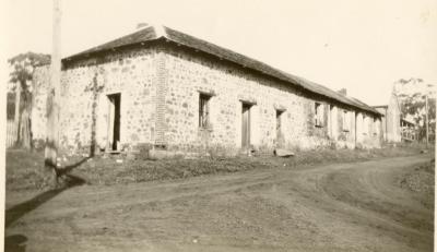
In 1859, there were 30 acres of vines in the Toodyay district. On 12 January 1861, sub-Lot 9 was allotted to Thomas Goggins, an Enrolled Pensioner Guard. He and his family left for Adelaide in 1862. By 1864, W Bull in partnership with A Stevens had established Avondale on Sub Lot 9. Viticulture became a prosperous industry in the Toodyay Valley, with the most successful vignerons being Bull and Stevens.
In 1885, more land was acquired, and 40 acres of vines was planted in 1891. In that year, they produced 5000 gallons of wine, a ton of dessert raisins and 4-5 tons of pudding raisins, although demand still exceeded supply. Stimulated by the gold rushes, they planted another 15 acres of vines in 1892 and built a 60 x 22 ft storeroom. They also grew peaches, apples, oranges and lemons. The place was the showplace of the district where distinguished visitors were escorted, and school concerts and children’s parties took place.
In 1893, the first Vine and Fruit growers Association in the colony was formed in Toodyay. Talk of a co-operative winery was opposed by Bull & Stevens who left the Association and formed the Deepdale Farmers and Fruit growers Association. In 1899, Bull & Stevens purchased all the local grapes to make 10,000 gallons of wine and produced 3000 oranges. When a state-wide association was formed in 1900, W Bull was one of the committee members.
(ref: inHerit - State Heritage Office)
Details
Details
On back of photo, in blue biro: "Bull & Steven ? Toodyay".
See also Shire of Toodyay photographs 2001.1264 & 2001.1281 for similar views.
Open in Google Maps
Nearest geotagged records:
- AVONDALE, TOODYAY (0km away)
- AVONDALE SCENE (0km away)
- World War 2, Western Australia, Rottnest Island Enlistments, W27415 to WX37034 WHITE, 1942 (1.16km away)
- DEEPDALE; VINEYARDS (1.17km away)
- SANCTA MARIA CHURCH, WEST TOODYAY (1.21km away)
- WASHAWAY FROM FLOOD AT MILL FARM (1.46km away)
- DRUMMOND'S MILL, TOODYAY (1.56km away)
- DRUMMOND'S STEAM MILL, TOODYAY (1.56km away)
- QUEENS HEAD INN (DELICENSED) AT WEST TOODYAY (1.75km away)
Nearby places: View all geotagged records »
More items like this
Other items from Shire of Toodyay
- CONNOR'S MILL (FORMER ROAD BOARD POWER STATION)
- DRUMMOND GRAVESITE ON HAWTHORNDEN
- STREET SCENE, STIRLING TERRACE, TOODYAY
- NEWGAIN GRANARY
- PILLOWSHAM
- FARM SHED
- HENRY JAMES AND SARAH HANNAH TWINE
- TOODYAY SHOWGROUNDS 1910-1933
- WARDERS' QUARTERS, TOODYAY
- MEMBERS ROOM AT THE TOODYAY RACECOURSE
- ST STEPHEN'S ANGLICAN CHURCH, STIRLING TERRACE, TOODYAY
- SANDALWOOD CARTERS
