COURSE AERIAL PHOTOGRAPHS 1967 AND 1968
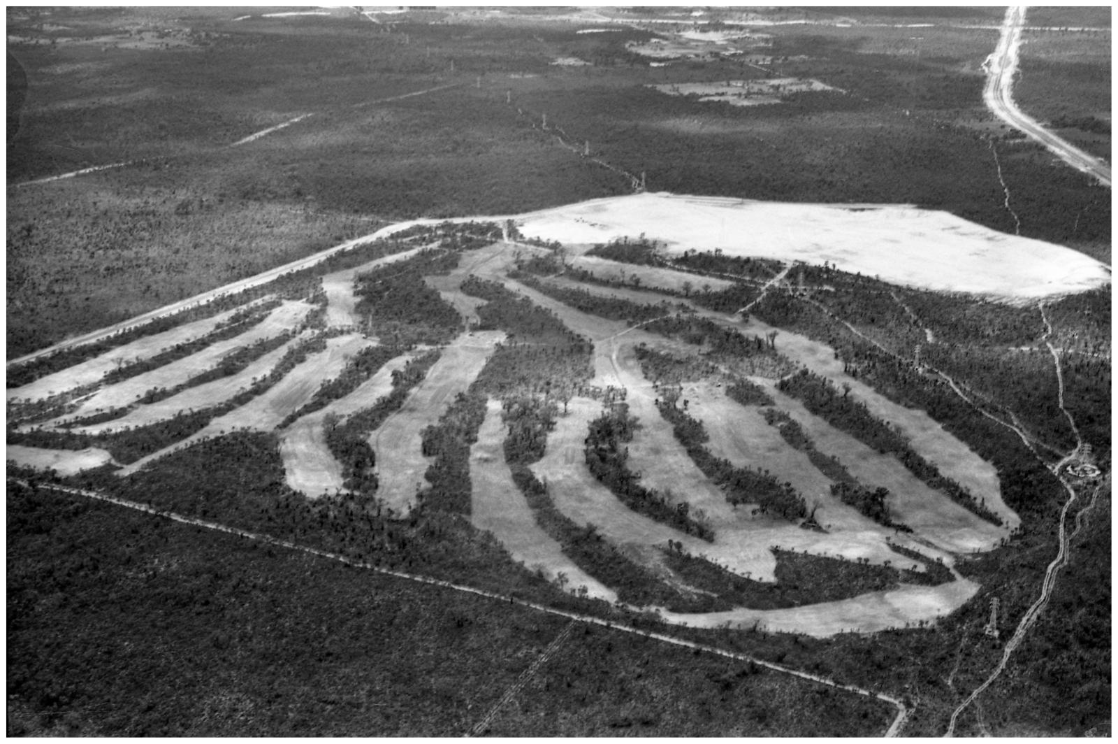
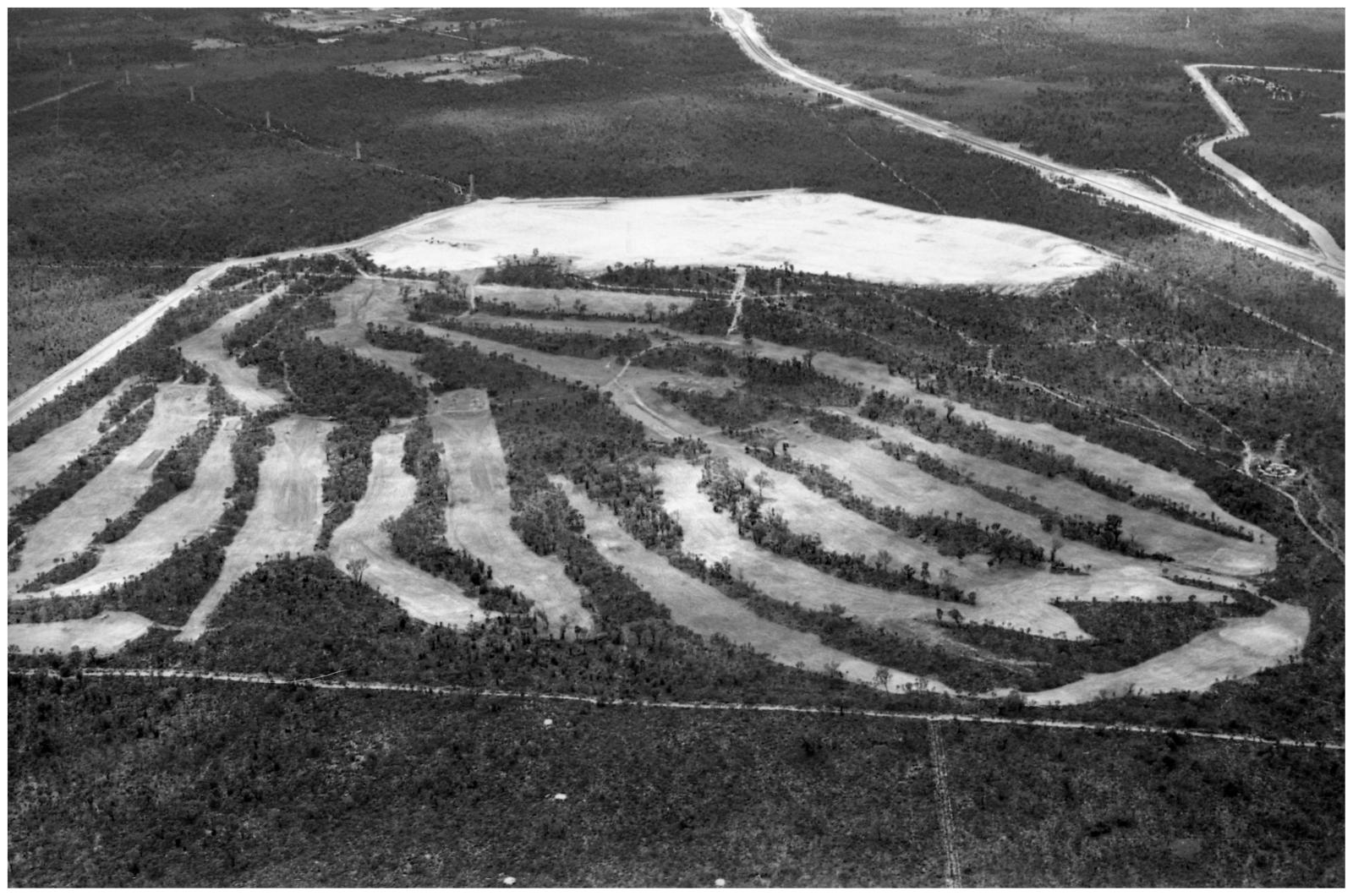
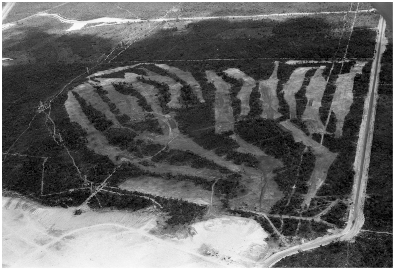
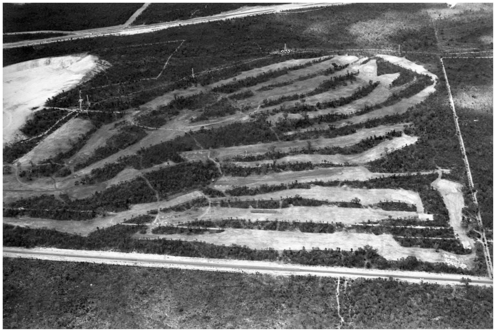
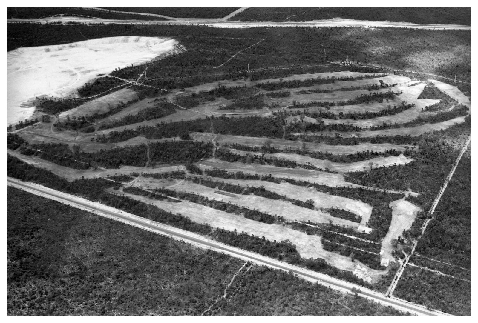
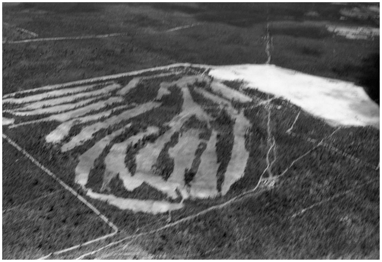
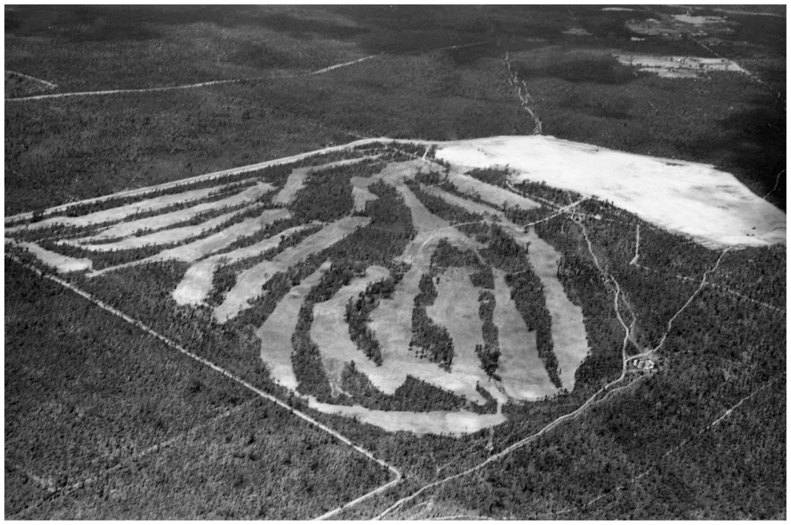
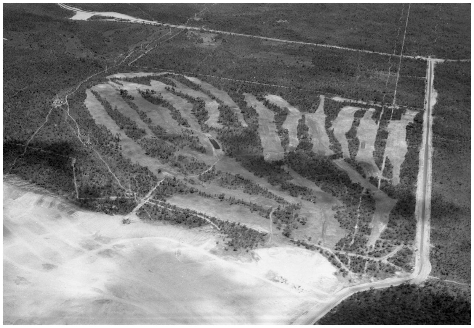
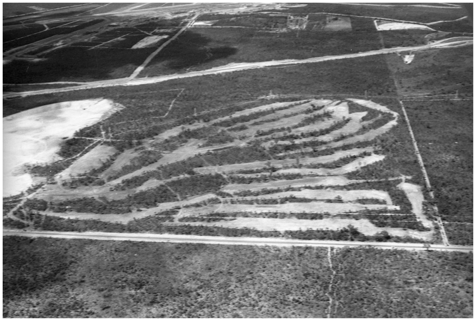
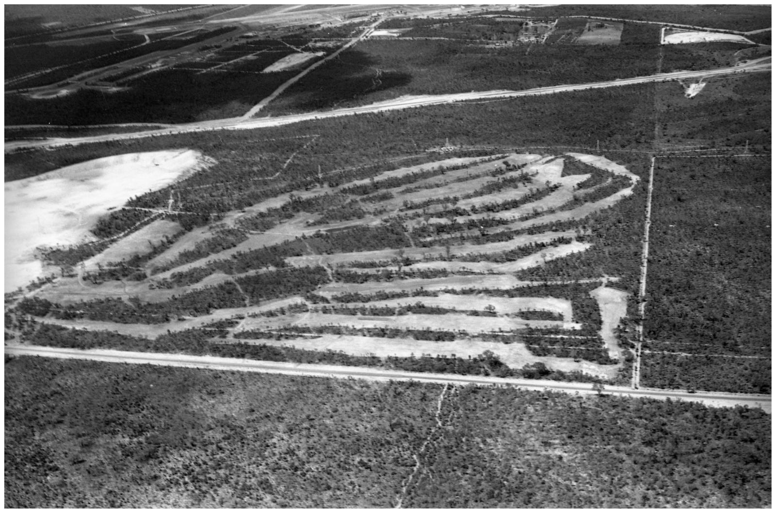
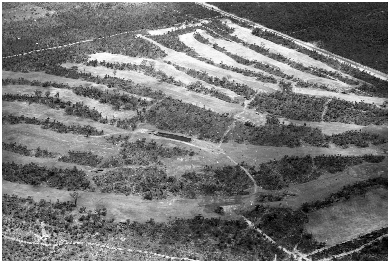
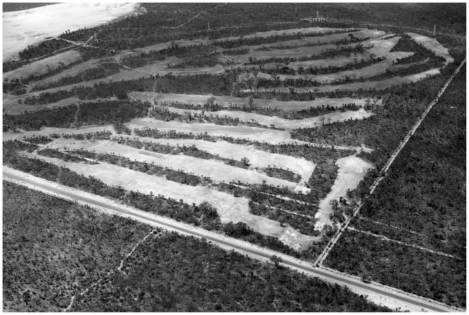
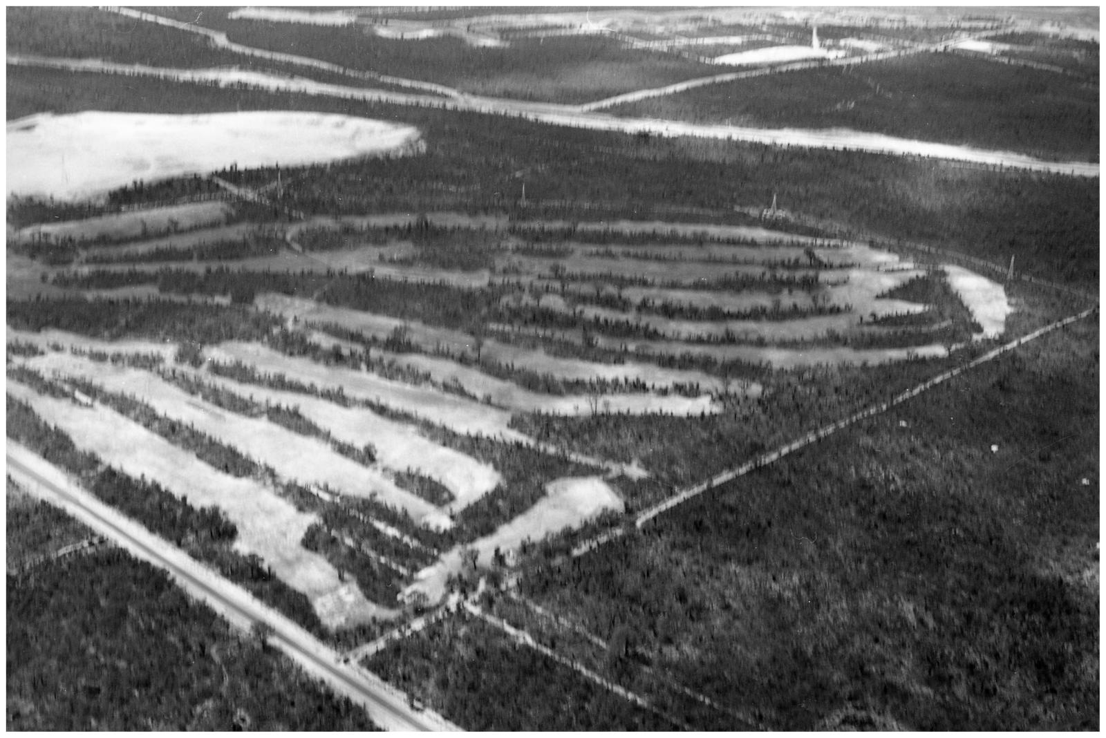
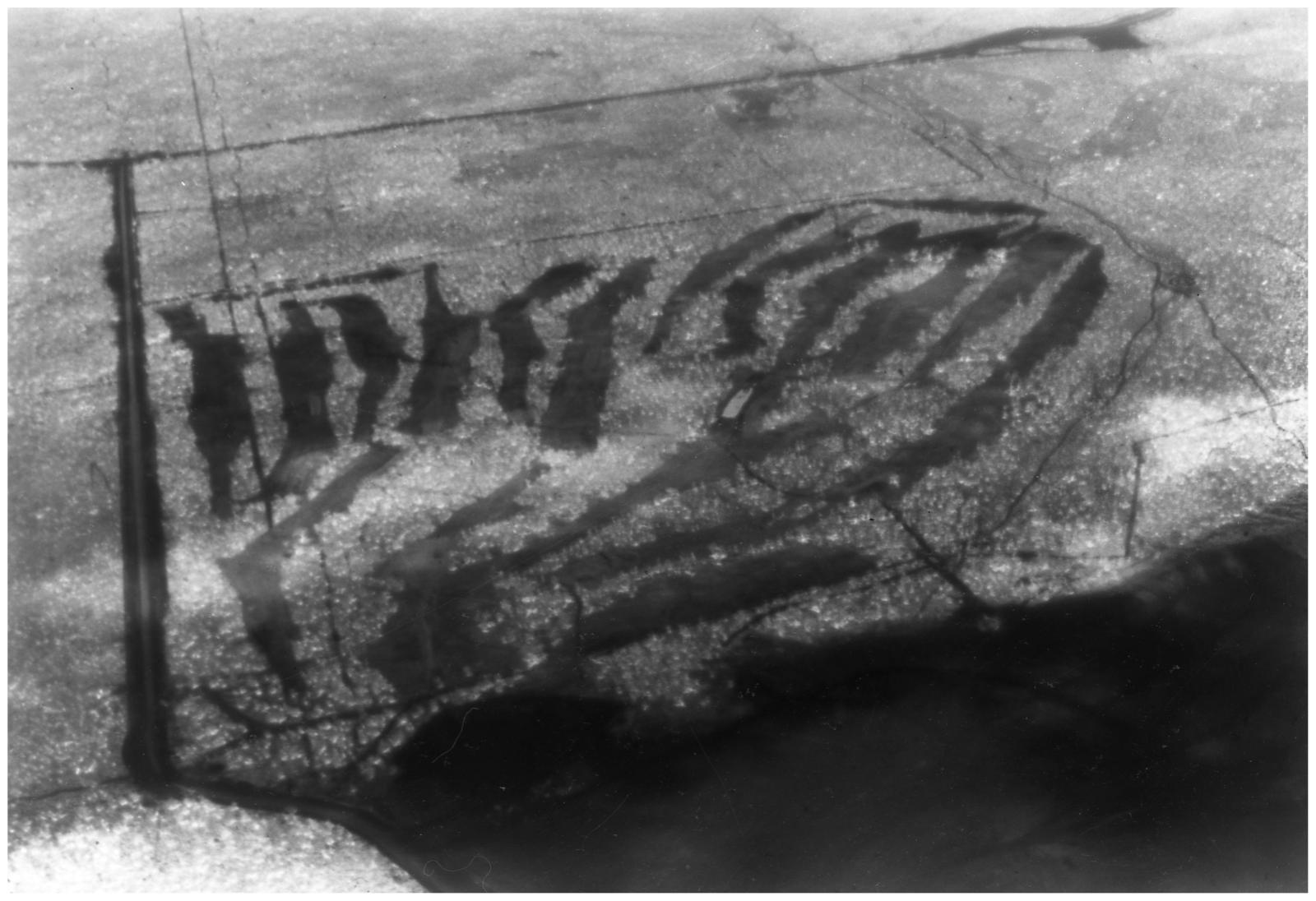
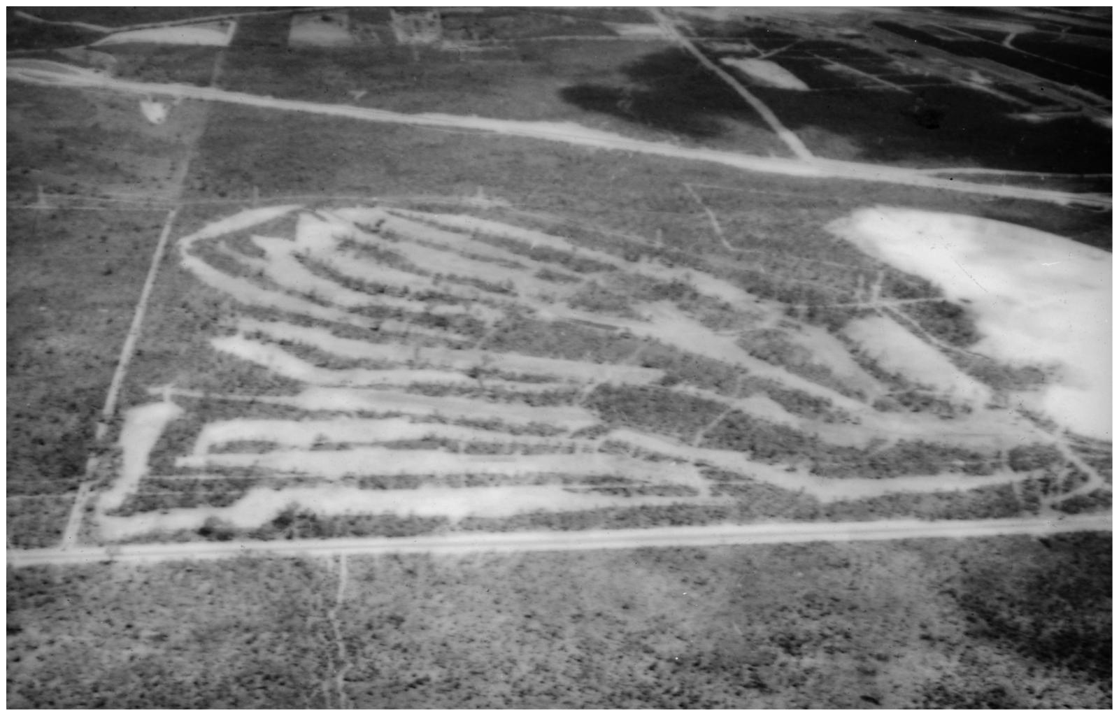
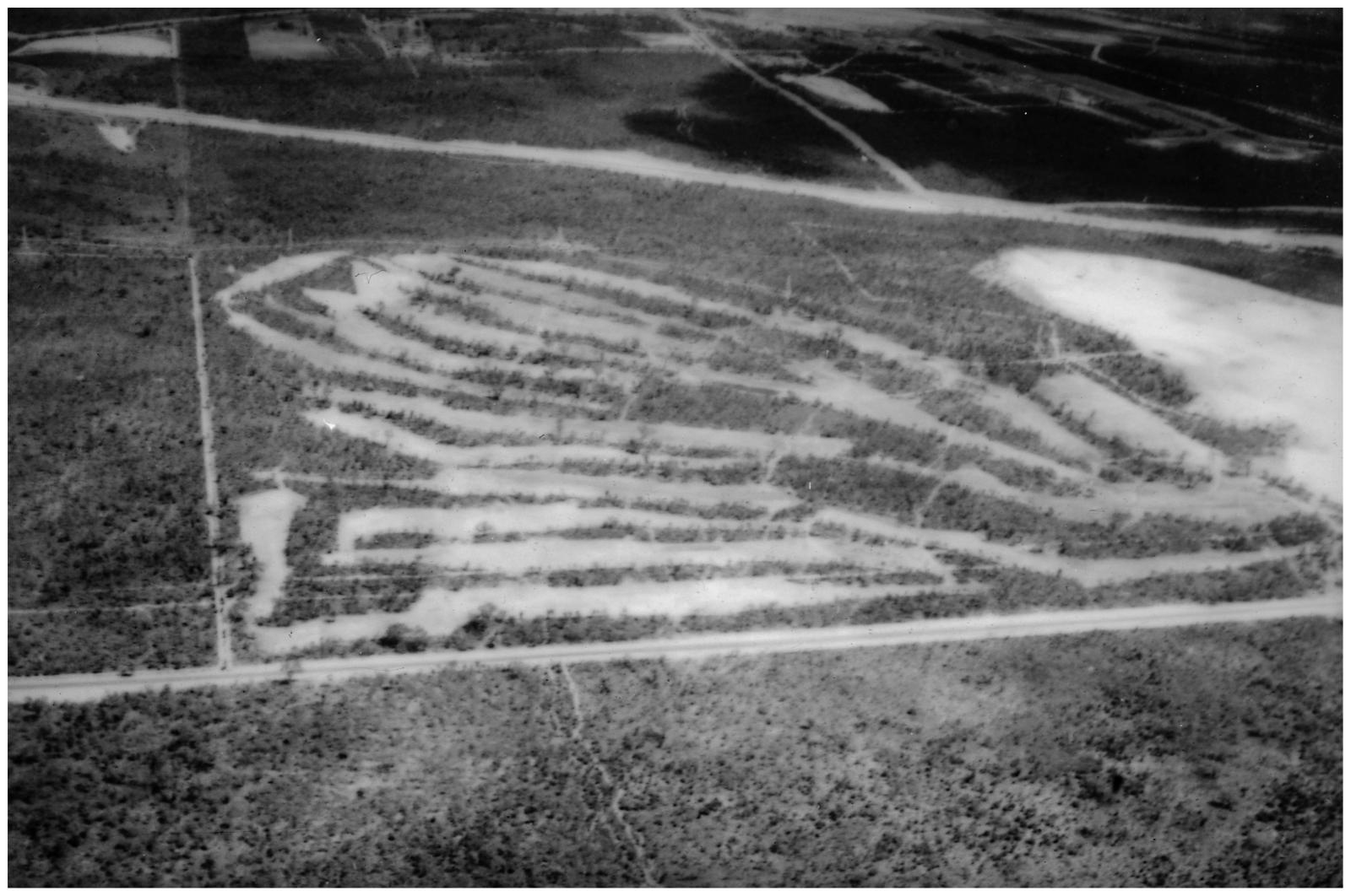
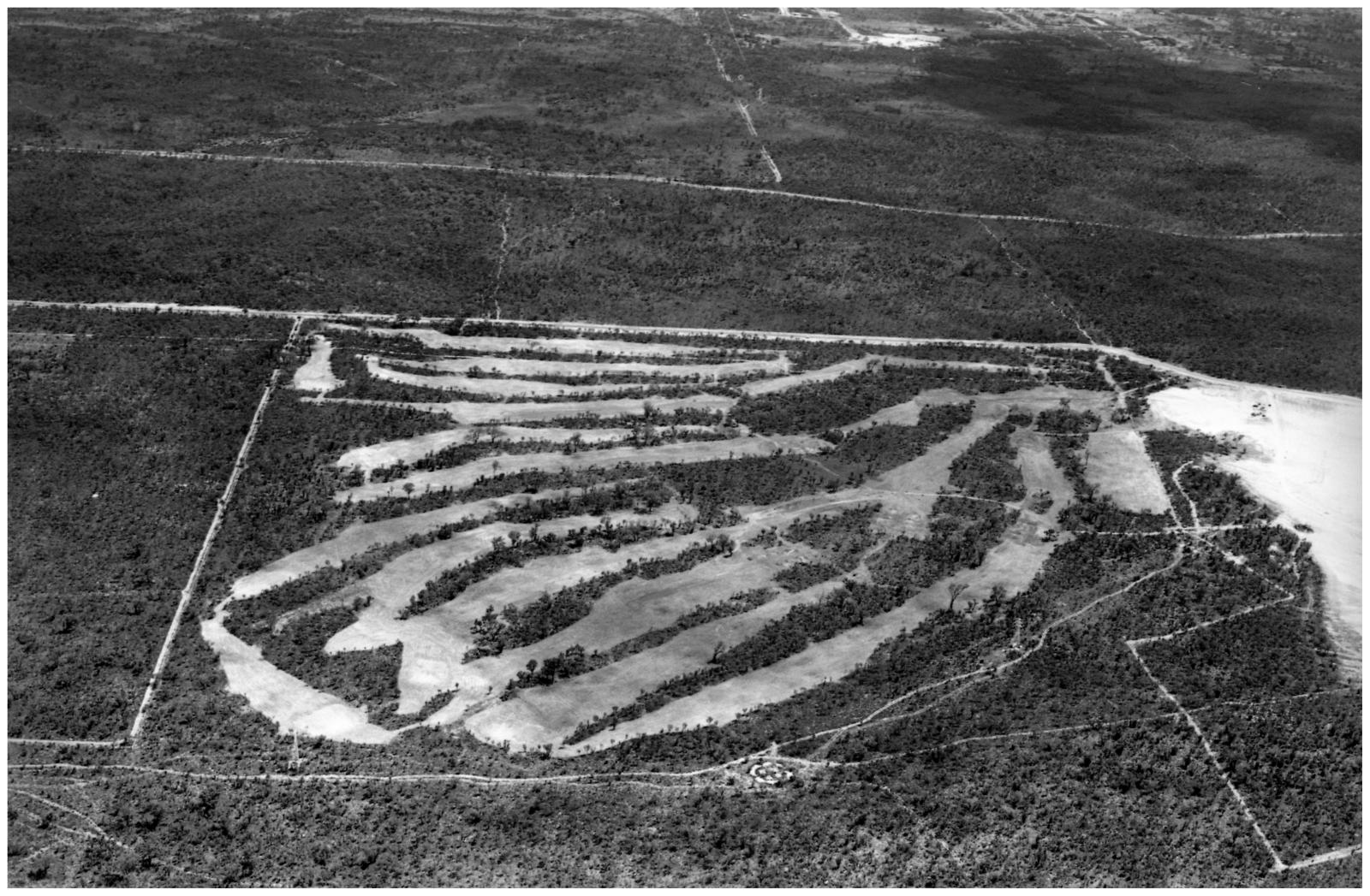
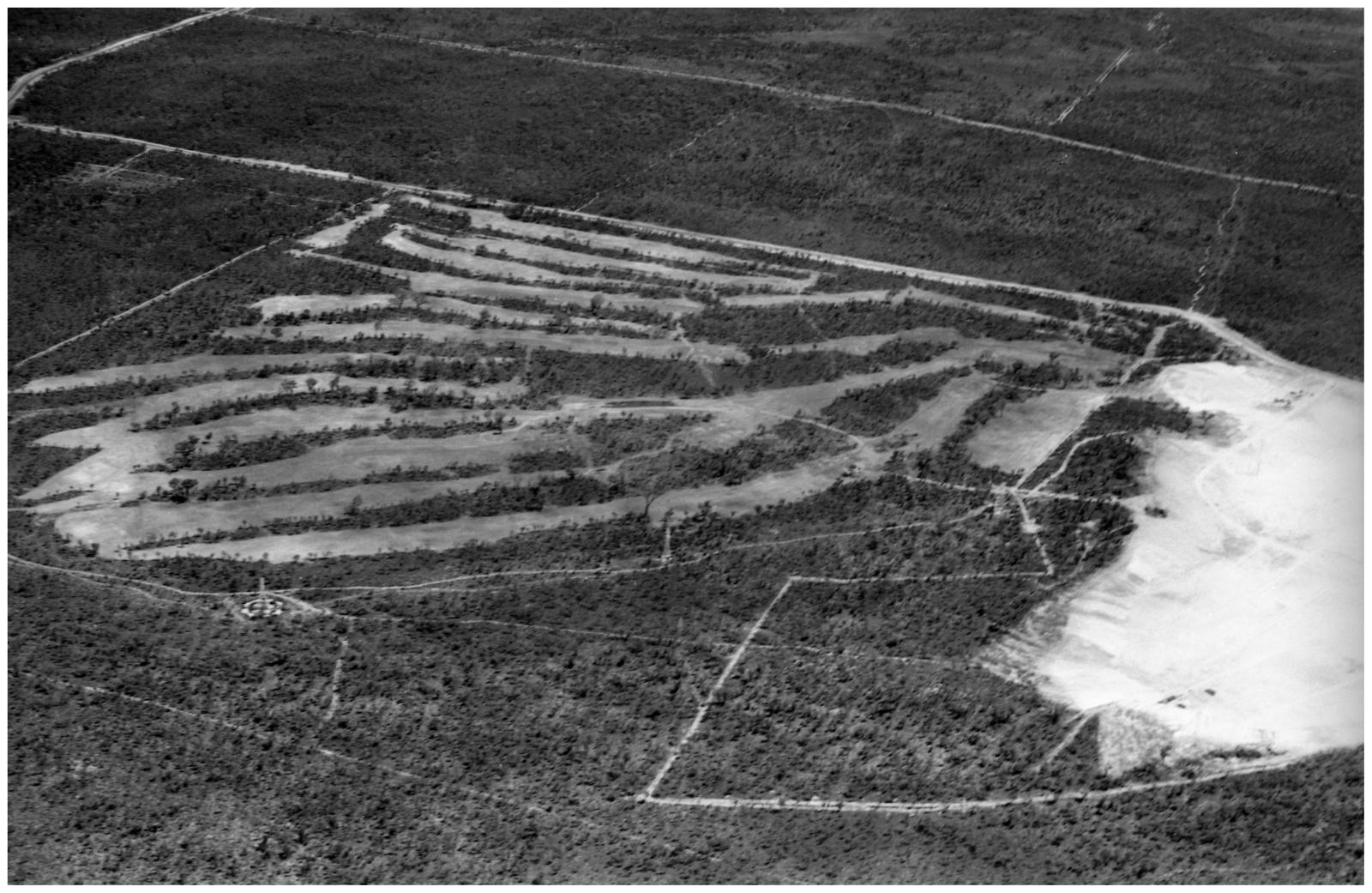
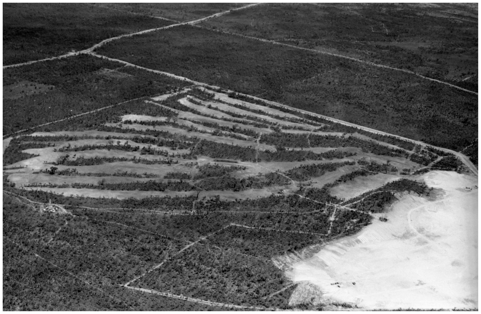
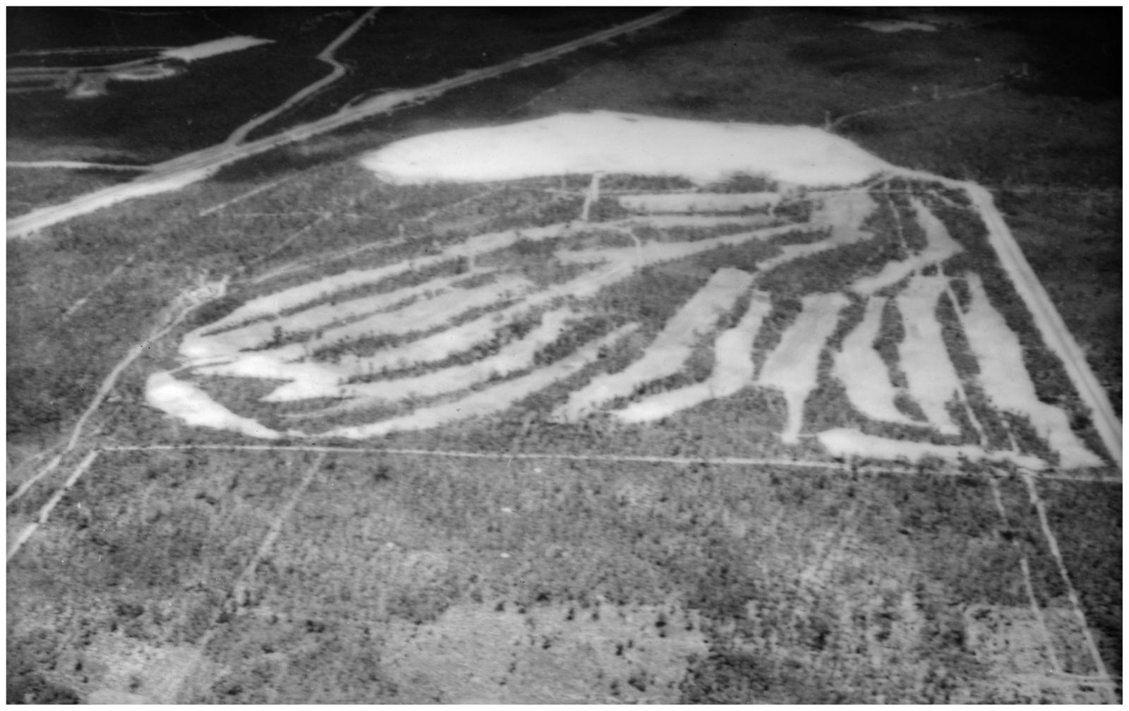
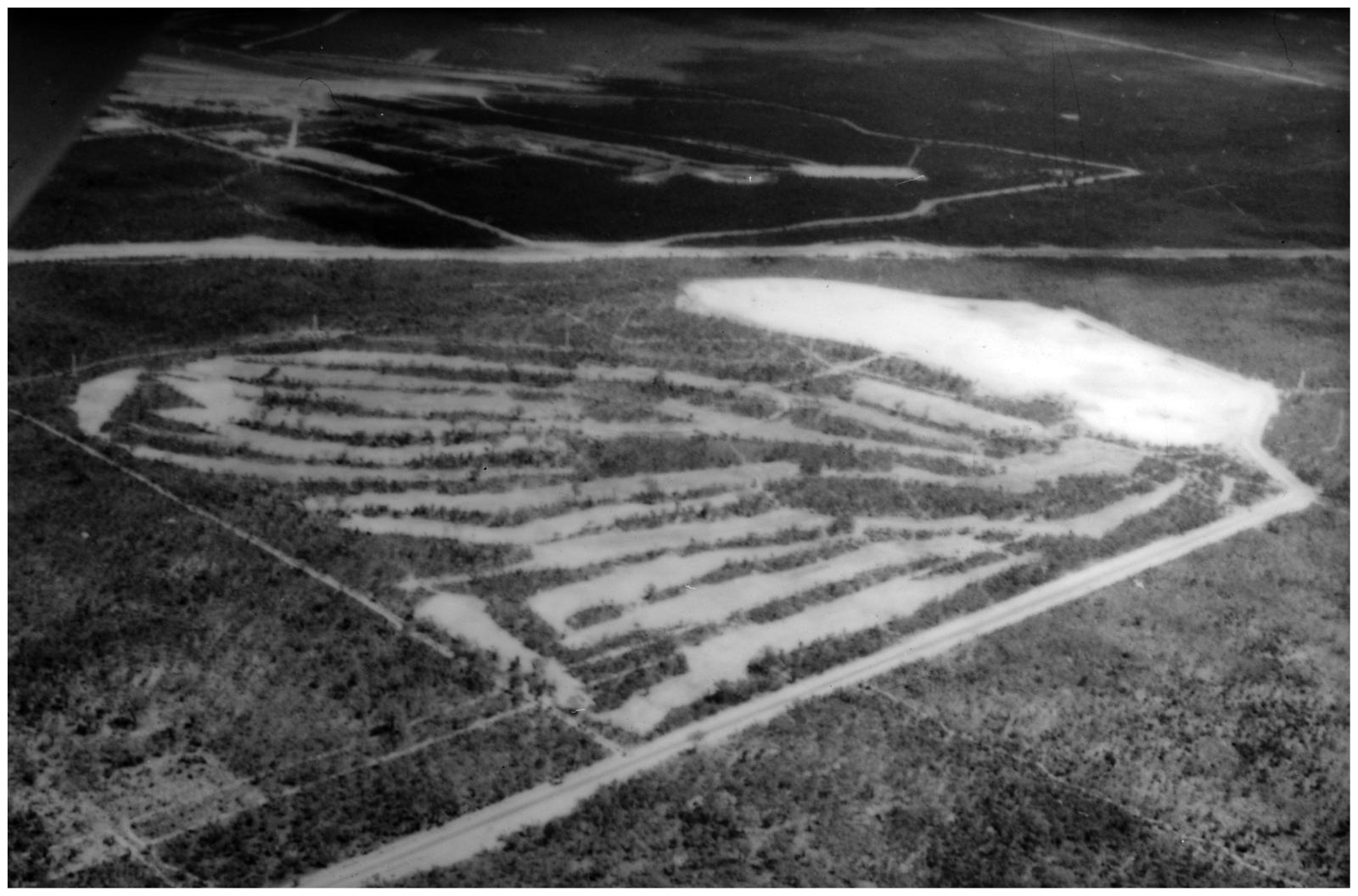
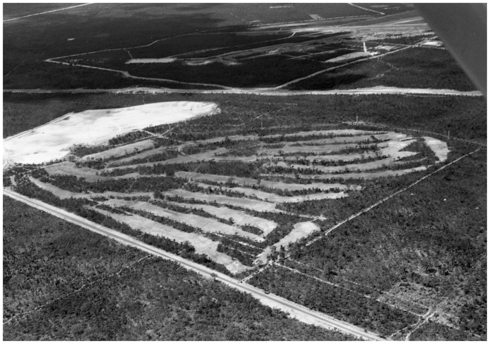
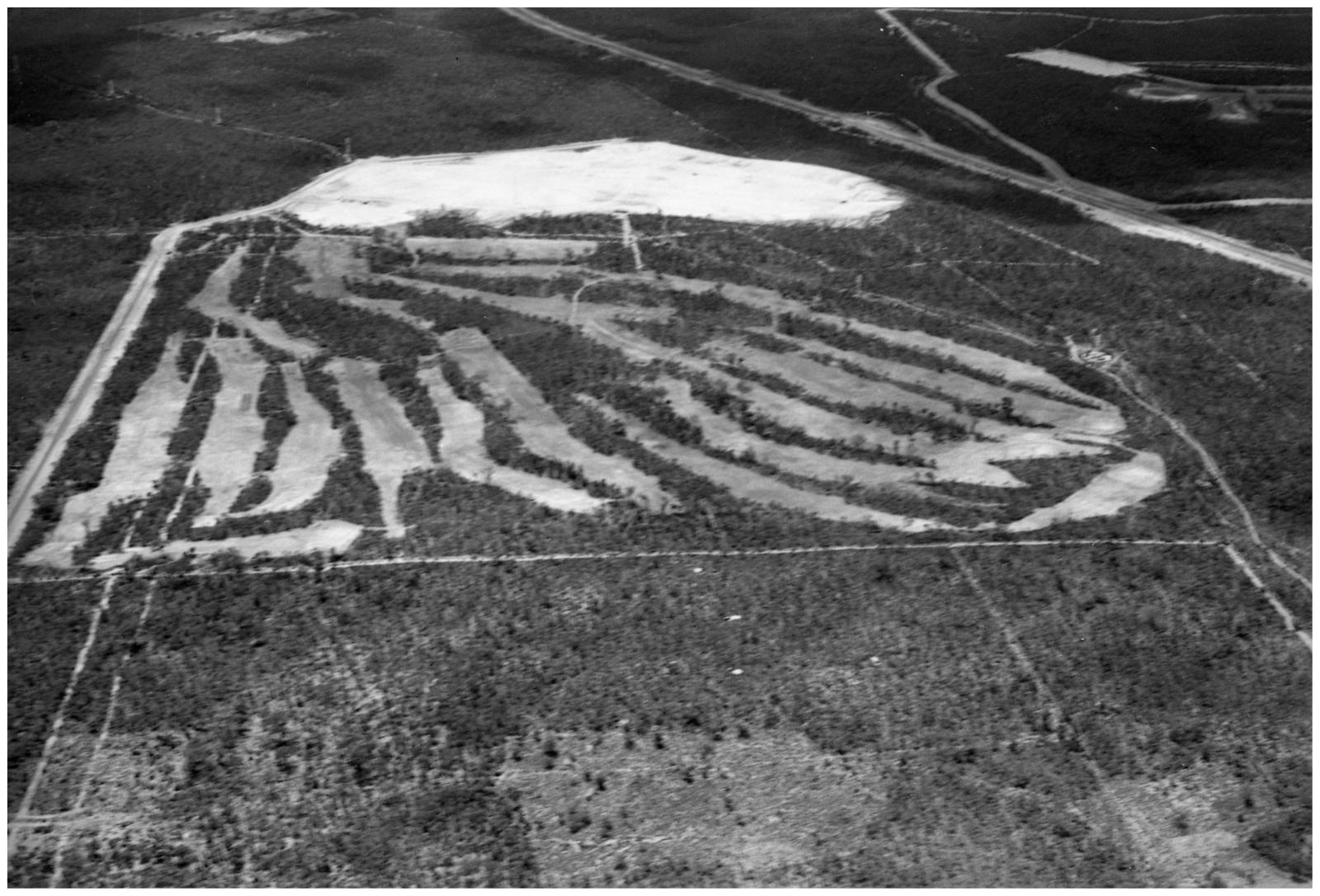
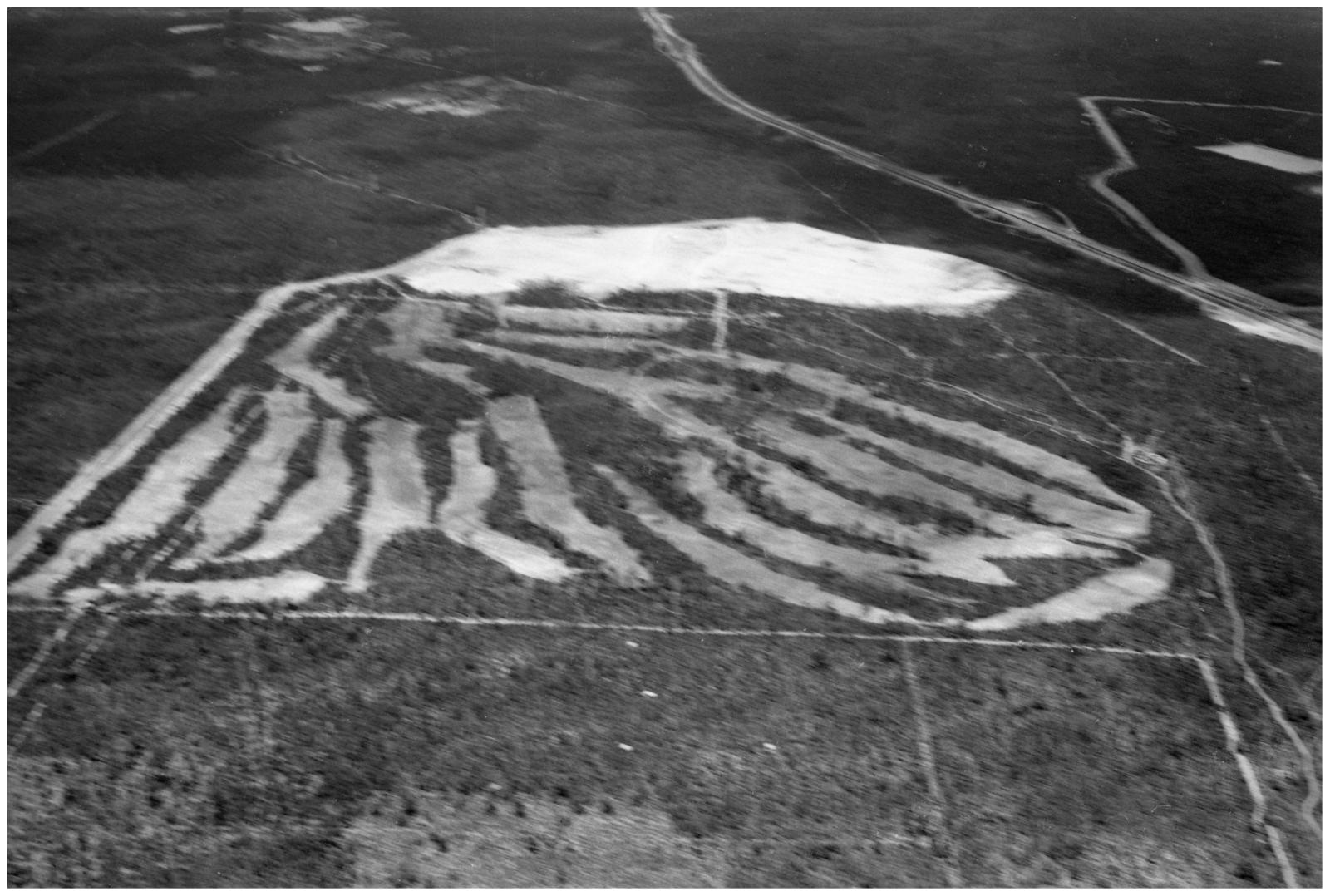
1967 - 1968During the original course construction, course architect Al Howard was keen to obtain aerial photography of his work. Two attempts were completed to satisfy this request. The first was mentioned in the Council of Management minutes which state that the Royal Aero Club at nearby Jandakot Airport had been arranged at no charge and that the West Australian newspaper photographer was to accompany the flight to obtain the images. This occurred in late September 1967 and showed the newly rotary-hoed fairways in five photographs. Howard was not totally satisfied with this first result due to the oblique angles of the views so a further flight early in January 1968 produced a further nineteen photographs, although many in this second set have poor focus and lighting.
The photographs have been obtained from negatives that have been professionally scanned at a high resolution. The orientation of the images changes as the flight circled the course. Clear in most photographs is the large sand pit located to the east of the property. The arrangement of golf holes can be relatively easily related to the current course layout to help understand the alignment of each photograph.
Details
Details
Related Topics
| Topic | Association | Dates |
|---|---|---|
| Club Formation | Course aerial photographs | 1967-1968 |
| MGGC Course History and Architects | Course aerial photographs | 1967-1968 |