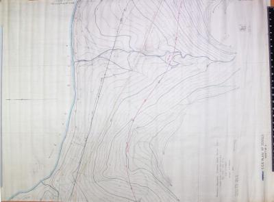
STANDARD GAUGE RAILWAY 1946 FREMANTLE TO KALGOORLIE MAP REFERENCES SG112/3R CCE 36028
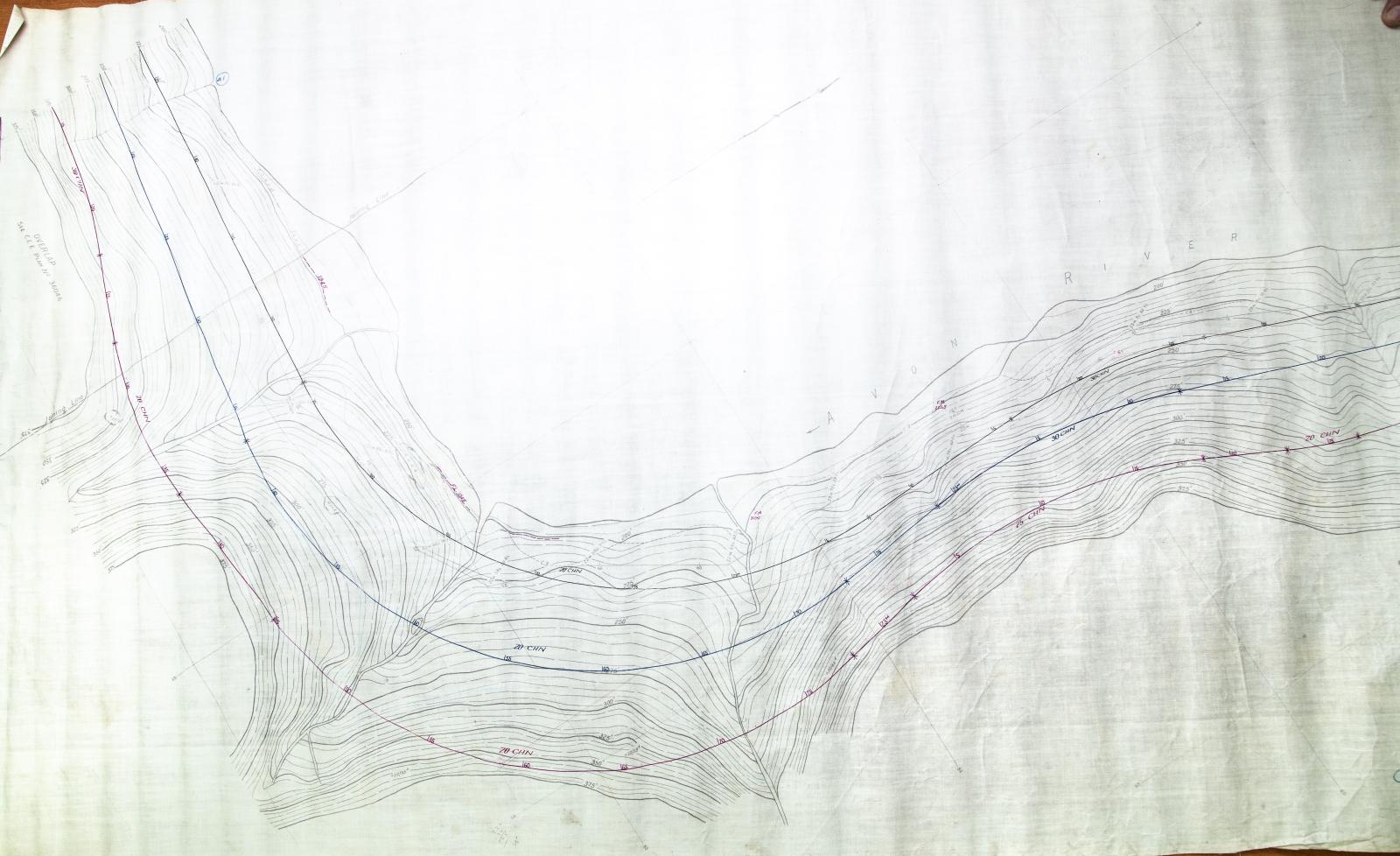
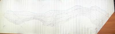
1946Avon River South Bank Contour Survey Map 1946 for Standard Gauge Railway
Map references SG112/3R CCE 36028 Mileage 22m 33ch - 23m 60ch (miles/chains). (36.69 - 38.22 Km).
Mileages on maps are believed to be calculated from Midland Station.
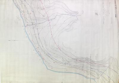
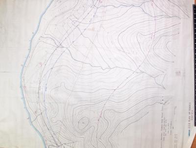
Shows contours and river bank.
Indicates flood levels from 1945.
Roads and streams marked.
Surveyor's notes added.
Surveyed by R.C. Rowe.
NB: Adjacent map SG113 is missing.
Historic: Survey in 1946 by HT Williams, HS Marriott and RC Rowe for Chief Civil Engineer WAGR for standard gauge link to Trans Australia Railway at Kalgoorlie.
Without an agreement in 1960 with BHP for an iron and steelworks at Kwinana to process iron ore for Koolyanobbing this project may not have taken place.
Project eventually started 5th November 1962 and the first standard gauge trains ran through Toodyay 11th November 1966 from Merredin. Completion to Kalgoorlie to join up with the Trans Australia SG Railway happened in 1968.
Originally part of the Railway Heritage WA Museum collection, this map had been deaccessioned and was then passed on to the Newcastle Gaol Museum by a Railway Heritage volunteer in c2015.
Details
Details
Other items from Shire of Toodyay
-
STANDARD GAUGE RAILWAY 1946 FREMANTLE TO KALGOORLIE MAP REFERENCES SG114/3R CCE 35960
-
STANDARD GAUGE RAILWAY 1946 FREMANTLE TO KALGOORLIE MAP REFERENCES SG115/1R CCE 35776
-
STANDARD GAUGE RAILWAY 1946 FREMANTLE TO KALGOORLIE MAP REFERENCES SG116/2R CCE 35839
-
STANDARD GAUGE RAILWAY 1946 FREMANTLE TO KALGOORLIE SURVEY MAP REFERENCES SG116/4R CCE 35839
-
STANDARD GAUGE RAILWAY 1946 FREMANTLE TO KALGOORLIE SURVEY MAP REFERENCES SG117/3R CCE 35840
-
STANDARD GAUGE RAILWAY 1946 FREMANTLE TO KALGOORLIE SURVEY MAP REFERENCES SG126/1R CCE 36289
-
STANDARD GAUGE RAILWAY 1946 FREMANTLE TO KALGOORLIE SURVEY MAP REFERENCES SG126/1R CCE 36289
-
STANDARD GAUGE RAILWAY 1946 FREMANTLE TO KALGOORLIE SURVEY MAP REFERENCES SG119/C CCE 35932/3
-
STANDARD GAUGE RAILWAY 1946 FREMANTLE TO KALGOORLIE SURVEY MAP REF: SG119/3 R3 SHEET 1 CCE 35932/3
-
STANDARD GAUGE RAILWAY 1946 FREO TO KAL SURVEY MAP REF: SG119/3 R4 CCE 35932/3
-
STANDARD GAUGE RAILWAY 1946 FRE TO KAL SURVEY MAP REF: SG120/2R CCE 35998
-
STANDARD GAUGE RAILWAY 1946 FREO TO KAL SURVEY MAP REF: SG122/2R CCE 36165