TOODYAY STATE SCHOOL, DUKE STREET, NORTH SIDE
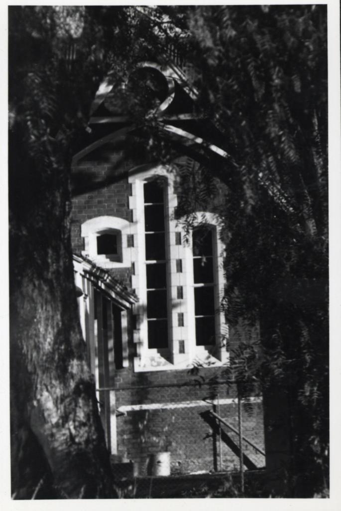
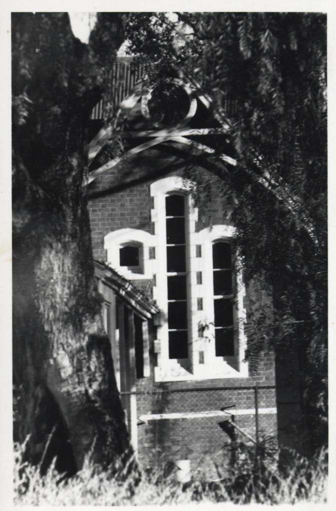
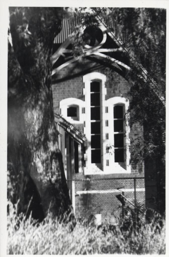
Three almost identical black & white prints of the north side of Duke Street School showing three windows. Photographs date prior to 1983. (date of earlier accession number)
The window on the left side shows one pane with a verandah extension obscuring the remainder of the panes, The centre window has six panes and the right window has four panes.
There is rendered brick work around windows with ten bricks exposed. There is wood trim on lower roof line. Partially visible is the roof of veranda on the left side and wooden veranda posts.
A cyclone fence is in middle ground. There is a large tree trunk on the left side and pepper tree foliage on the right. A metal container is below the windows.
Print (a): Long grass in foreground.
Print (b): Grass in foreground appears shorter.
Print (c): Grass barely visible, and darker contrast.
The old Newcastle School, located on Duke Street, was the first purpose built school in the new town site of Toodyay (then known as Newcastle). It operated as a school from 1887 to 1954.
In 1954 the new Toodyay District High School opened and Duke Street closed.
From 1955 to 1959, various parts of the old school site were leased to local groups, such as the St John Ambulance Association, the Toodyay Repertory Club, and the Toodyay Basketball Association. In 1959 the Repertory Club bought the property.
In 1962 the local Methodist Church on Duke Street was demolished to make way for the new standard gauge railway; the Methodist Churches Trust bought the school building from the Repertory Club for use as a chapel, with the first service held on 15 November 1964.
By 1979 the building was known as the Uniting Church, the Methodist Church having merged with other churches in 1977 to form the Uniting Church in Australia. In 2007 the Uniting Church sold the property to a private owner.
Details
Details
Open in Google Maps
Nearest geotagged records:
- TOODYAY STATE SCHOOL, DUKE STREET, WEST SIDE (0km away)
- LEE-STEERE'S HOUSE (ANGLICAN RECTORY), TOODYAY (0.06km away)
- OLD POLICE STABLES, TOODYAY (0.09km away)
- ABORIGINAL CELL - NEWCASTLE GAOL, TOODYAY (0.09km away)
- NEWCASTLE GAOL, NORTH SIDE WALL, LOOKING WEST (0.1km away)
- PART OF NEWCASTLE GAOL (0.1km away)
- GROVES' HOUSE, 8 FIENNES STREET, TOODYAY (0.11km away)
- HOUSE - 8 FIENNES STREET TOODYAY (0.11km away)
- STANDARD GAUGE RAILWAY LINE DOZER AND SCRAPER, TOODYAY 1964 (0.11km away)
- OLD GAOL MUSEUM DISPLAY, KITCHEN (0.11km away)
Nearby places: View all geotagged records »
Other items from Shire of Toodyay
- CARD, NEW YEAR
- 'THE CASCADES' HOUSE IN FOLEWOOD ROAD, TOODYAY
- STREET SCENE WITH HORSE DRAWN VEHICLE AND PASSENGERS
- FRAMEWORK OF SLAUGHTER HOUSE AND PEN, WEST TOODYAY
- FRAMEWORK OF SLAUGHTER HOUSE, WEST TOODYAY
- TOODYAY COUNTRY WEEK CRICKET TEAM, 1946 or 1947
- PROPERTY; MANMANNING WHEATBELT PROPERTY, OWNED BY PETER SALVAIRE
- THREE TROPHIES FOR THE TOODYAY WHEELBARROW RACE
- TOODYAY WHEELBARROW RACE
- FLOAT IN STREET PARADE
- SMALL METAL WORLD GLOBE WITHOUT STAND
- ROYAL AUSTRALIAN NAVAL RESERVE BAND ON STAGE
