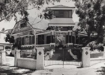
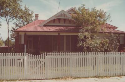
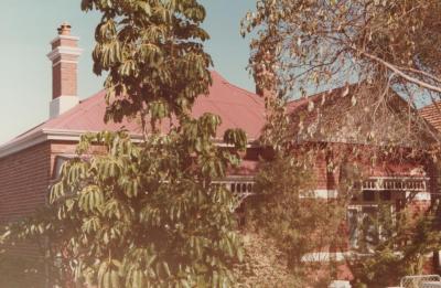
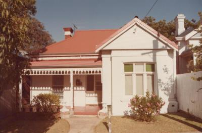
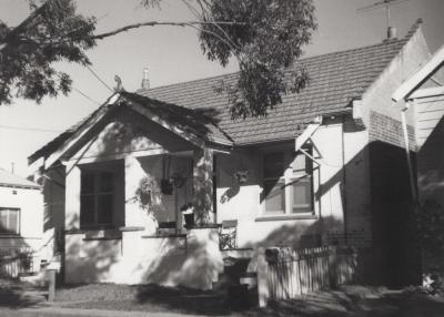
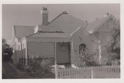
PHOTOGRAPH: 12 KINGS ROAD, NATIONAL ESTATE SURVEY COLLECTION
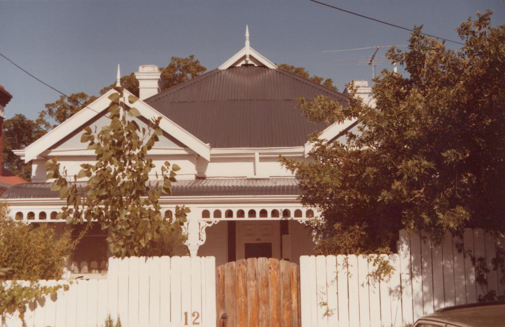
1985Coloured photograph of a house at 12 Kings Road. The house is symmetrical. It has a dark grey roof. There is a small gable on top of the roof with a finial fixed on top. There are two white chimneys. Most of the house is painted white. There are two larger gables with finials fixed on top. There is a bull nosed verandah with a dark grey tin roof. The roof is supported by decorated wooden beams. There is a white wooden decorative framework attached beneath the roof of the verandah. There is a white wooden picket fence with a wooden gate in front of the house. The wooden gate is placed in the middle of the image in front of the main entrance. The number '12' is seen on the fence to the left of the wooden gate. There are large trees and bushes partially covering the house. There are large trees in the background of the image.
Reverse: Written on the reverse in blue pen '12 Kings Rd.' and '7/20'
From a series of photographs taken by Ian Molyneux for the National Estate Survey of Subiaco in 1985.
The house was constructed from 1906.
On 13 March 1883, the Western Australian government announced it would survey a section of the Perth Commonage into suburban lots and that these would then be made available for private sale. This subdivision had created 141 residential allotments with frontages to the southern side of Bagot Road, eastern side of Townsend Road, north-western side of Thomas Street, northern side of Hamersley Road, and to both sides of Francis Street, Park Street (now Kings Road) and Market Street (now part Bedford Avenue). By 1906, measures were being taken to ensure that Kings Road (together with adjacent streets) was developed with good quality housing. In January it was reported that Kings Road was one of several local streets where preparations were in place for providing a permanent water supply via extensions to the water mains; while in September, it was reported that it was one of several streets that had been topped with limestone ballast. Development then progressed rapidly with a further 8 houses being built in 1906-1908: 6, 7, 8, 11, 12, 14, 16 & 25. After a short hiatus, the remainder of the street was gradually developed over an 11 year period.
Details
Details
Ian Molyneux
From a series of photographs taken by Ian Molyneux for the National Estate Survey of Subiaco in 1985.
Other items by Ian Molyneux
-
PHOTOGRAPH: 178 PARK STREET, NATIONAL ESTATE SURVEY COLLECTION
-
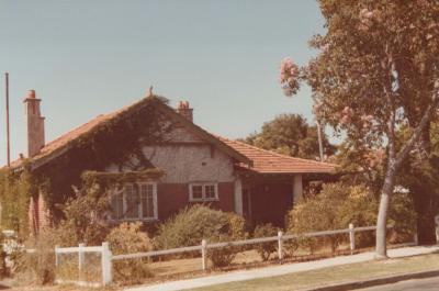
PHOTOGRAPH: 85 HEYTESBURY ROAD, NATIONAL ESTATE SURVEY COLLECTION
-
PHOTOGRAPH: 123 HEYTESBURY ROAD, NATIONAL ESTATE SURVEY COLLECTION
-
PHOTOGRAPH: 139 COGHLAN ROAD, NATIONAL ESTATE SURVEY COLLECTION

-
PHOTOGRAPH: UNKNOWN HOUSE BAGOT ROAD, NATIONAL ESTATE SURVEY COLLECTION
-
PHOTOGRAPH: 9 ROSEBERY STREET, NATIONAL ESTATE SURVEY COLLECTION
-
PHOTOGRAPH: 105 COGHLAN ROAD, NATIONAL ESTATE SURVEY COLLECTION
-
PHOTOGRAPH: 10 KERSHAW STREET, NATIONAL ESTATE SURVEY COLLECTION
-
PHOTOGRAPH: UNKNOWN HOUSE COGHLAN ROAD, NATIONAL ESTATE SURVEY COLLECTION
-
PHOTOGRAPH: 44 BEDFORD AVENUE, NATIONAL ESTATE SURVEY COLLECTION
-
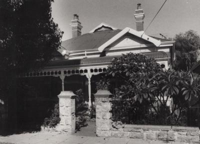
PHOTOGRAPH: 121 RUPERT STREET, NATIONAL ESTATE SURVEY COLLECTION

-
PHOTOGRAPH: 81 OLIVE STREET, NATIONAL ESTATE SURVEY COLLECTION

More items like this
Other items from Subiaco Museum
-
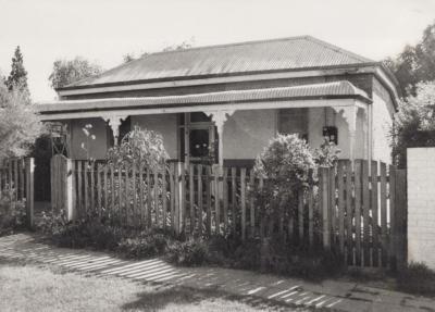
PHOTOGRAPH: 10 KINGS ROAD, NATIONAL ESTATE SURVEY COLLECTION
-
PHOTOGRAPH: 11 SMYTH ROAD, NATIONAL ESTATE SURVEY COLLECTION
-
PHOTOGRAPH: 20 UNION STREET, NATIONAL ESTATE SURVEY COLLECTION
-
PHOTOGRAPH: 17 SMYTH ROAD, NATIONAL ESTATE SURVEY COLLECTION
-
PHOTOGRAPH: 19 SMYTH ROAD, NATIONAL ESTATE SURVEY COLLECTION
-
PHOTOGRAPH: 17 KEIGHTLEY ROAD EAST, NATIONAL ESTATE SURVEY COLLECTION
-
PHOTOGRAPH: 15 KEIGHTLEY ROAD EAST, NATIONAL ESTATE SURVEY COLLECTION
-
PHOTOGRAPH: UNKNOWN HOUSE KEIGHTLEY ROAD EAST, NATIONAL ESTATE SURVEY COLLECTION
-
PHOTOGRAPH: 14 AUSTIN STREET, NATIONAL ESTATE SURVEY COLLECTION
-
PHOTOGRAPH: 18-32 CATHERINE STREET, NATIONAL ESTATE SURVEY COLLECTION
-
PHOTOGRAPH: 15 ARTHUR STREET, NATIONAL ESTATE SURVEY COLLECTION
-
PHOTOGRAPH: 95 ONSLOW ROAD, NATIONAL ESTATE SURVEY COLLECTION