Map of Farms
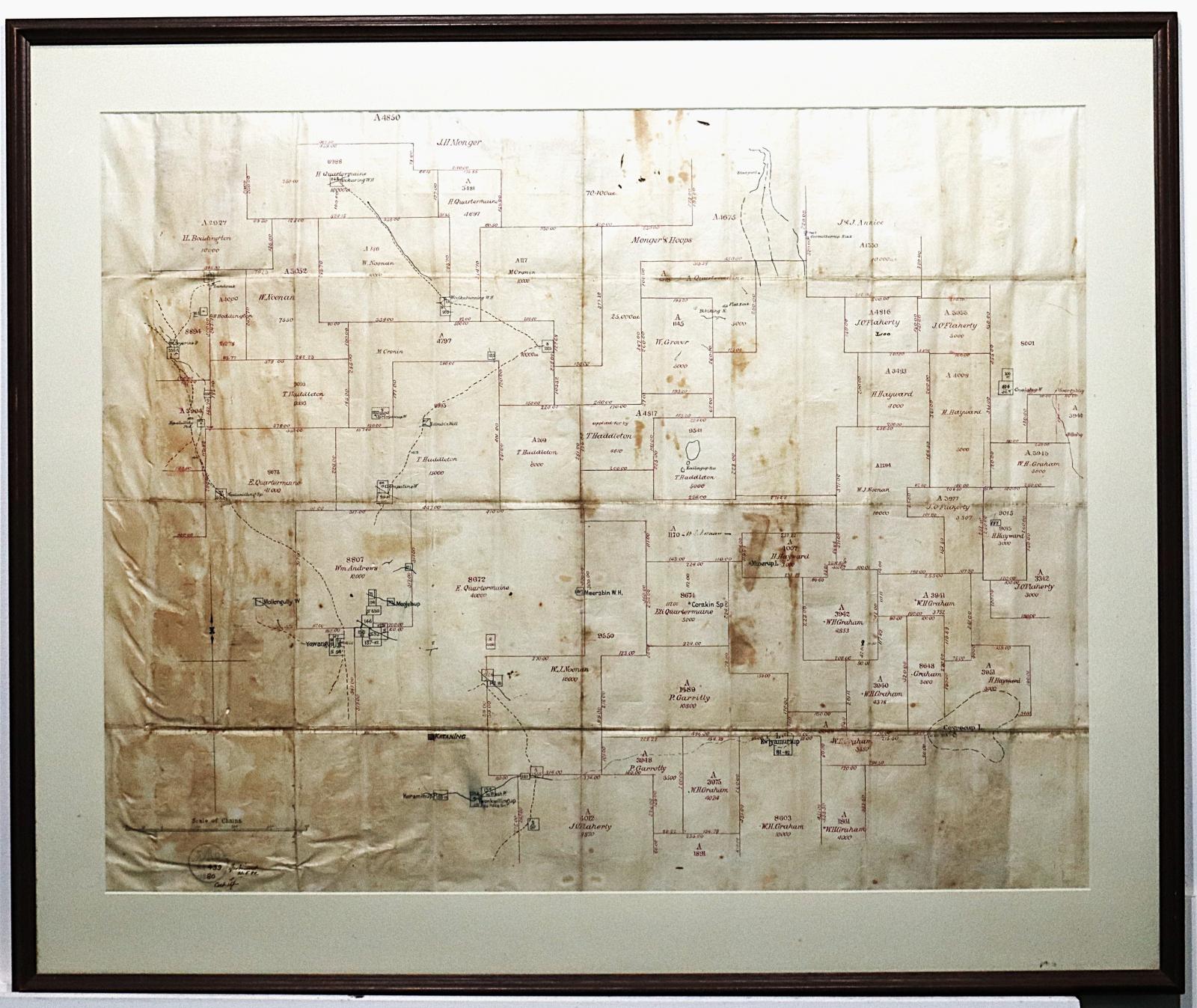
c. 1880Location map of early settlement around the area of the Katanning township.
The map shows location of early settlement around Katanning, names such as "Andrews", "Boddington", "Cronin", "Garrotty", "Graham", "Grover", "Haddleton", "Hayward", "Monger", "Monger & Hoops", "Noonan", "O'Flaherty" and "Quartermaine".
Places that are marked include "Ewlyamurtup", "Coyrecup Lake", "Katanning", "Koraminup", "Meerabin", "Minerup", "Twonkwillingup (old Police Sn.)", "Yowangup"
Details
Details
At the bottom left of the map is a stamp and inside is "S O" and below this is "N8439" and below this is "1880". Below the stamp handwritten in brown ink is "15/-"
To the right of the stamp handwritten in brown ink is "? 21.5.80"
Copyright and Reference
Copyright and Reference
Courtesy of Katanning Historical Society.
Other items from Katanning Historical Society
Scan this QR code to open this page on your phone ->
