Links to additional resources
Trench Maps (1:20,000 scale, 1:10,000 scale and larger)
Overview
In January 1915 it was decided to produce maps from a new survey of the ground on the British fighting front. The maps produced under this direction were to be used by the Australian Imperial Force headquarters and units in France and Belgium From early in 1915 the Geographical Section of the General Staff, began to produce Trench Maps for the fighting units at the Front. Maps in the scale of 1:20,00, 1:10,000 and greater are commonly referred to as “Trench Maps” They were canvassed backed for durability and designed to be folded for portability.
Historical information
Maps for the British Army in areas of France where they were holding the Front Line north of Arras during 1915 began to be produced from new Army survey work at a scale of 1:20,000. Subsequently new larger scale Trench Maps were drawn at a scale of 1:10,000. These maps showed details of the enemy Front Line, machine gun posts, bunkers, communication trenches to the rear and any defensive positions behind the Front Line.
From 1915 until early in 1918 the enemy (German) positions were shown in red. In the last months of the war, the colours were reversed to comply with the French system of map symbols. The British Front Line was generally only shown as a simple “approximate” line for the purposes of its location. Any maps which did show details of the British Front Line and supporting lines were classified as “Secret” and were not supposed to be taken beyond the Brigade Headquarters into the Front Line positions for fear they might be captured by the enemy in a trench raid or be discovered in the pocket of a dead officer during an attack.
Details
Details
Registration number
cwa-org-32-99-783
Inscriptions and markings
British Army Trench Maps are an invaluable resource for researchers studying the World War 1 battlefields. They show the location of Front Lines, communication trenches, enemy positions, strongpoints and defences. They also show the names of farms, woods and villages which have become famous in themselves where they feature in the regimental histories, personal stories and War Diaries of the British Army in the battles on the Western Front.
Contextual information
The Australian Army Museum of WA has several hundred trench maps from the Western Front in its collection. Of particular significance are those marked with operational details such as arcs of fire, attack plans or artillery barrages. These original maps appear in specific exhibits. Copies of trench maps for the backdrop of World War 1 exhibit cases. Since the collection of these maps, numerous sources have made digital copies readily available on line. The Museum's collection of maps has been indexed and remains in archival storage.
Last modified
Tuesday, 22 August, 2023
Australian Army Museum of Western Australia
Australian Army Museum of Western Australia
Other items from Australian Army Museum of Western Australia
-
World War 1, Australia, Western Australia, 431 LEE, 10 Light Horse
-
World War 1, Australia, Western Australia, 387 CROWE, 10 Light Horse
-
World War 1, Australia, Western Australia, 433 LIVESEY, 10 Light Horse
-
World War 1, Australia, Western Australia, 384 COLE, 10 Light Horse
-
World War 1, Australia, Western Australia, 380 BUTLER, 10 Light Horse
-
World War 1, Australia, Western Australia, 379 BUNCE, 10 Light Horse
-
World War 1, Australia, Western Australia, 374 BRENNAN, 10 Light Horse
-
World War 1, Australia, Western Australia, 351 WILLIAMS, 10 Light Horse
-
World War 1, Australia, Western Australia, 372 BLAKE, 10 Light Horse
-
World War 1, Australia, Western Australia, 370A BESSEN, 10 Light Horse
-
World War 1, Australia, Western Australia,BEARD, 10 Light Horse
-
World War 1, Australia, Western Australia, 365 BENNETT, 10 Light Horse
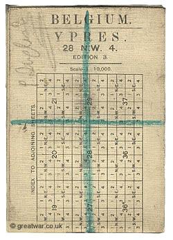
Folded Trench Map 1:10,000 Scale
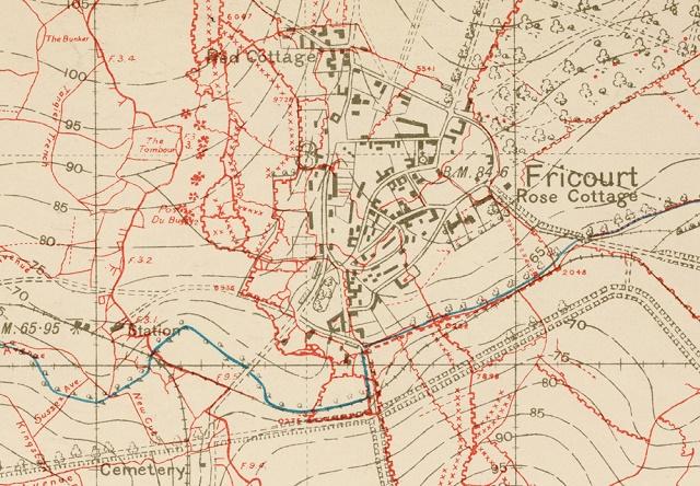
Detail from Trench Map
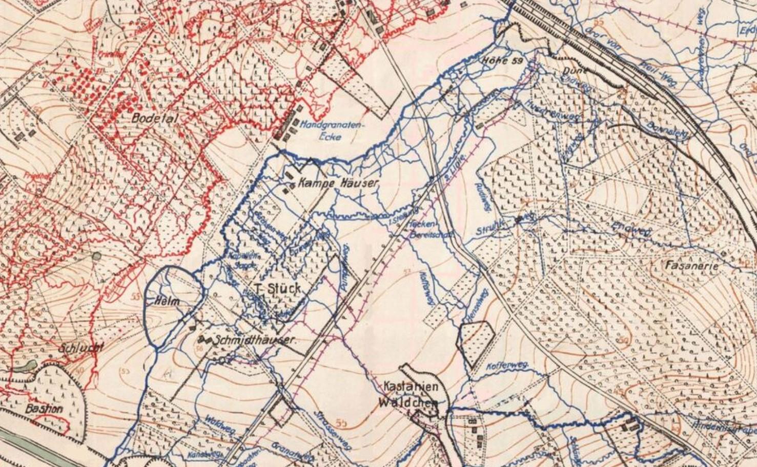
Detail of 1918 Trench Map
Scan this QR code to open this page on your phone ->